
West Coast Tasmania Travel Guide: Best Places to Visit & Things to Do
West Coast Tasmania feels very different from the island’s more sheltered eastern and northern regions. Rainforest presses towards winding roads, mountains rise sharply behind small towns, rivers disappear into remote wilderness and the Southern Ocean reaches an exposed coastline shaped by wind, rain and distance.
For many travellers, this is one of the parts of Tasmania where the journey matters as much as the destination. Roads cross the Franklin–Gordon Wild Rivers landscape, descend through steep mountain country around Queenstown and eventually reach places such as Strahan, Zeehan, Rosebery and Tullah.
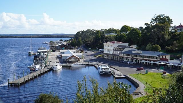
The West Coast is also deeply connected with Tasmania’s mining, railway and maritime history. Queenstown’s surrounding hills tell a very different story from the rainforest nearby. Zeehan preserves the legacy of one of Tasmania’s important mining districts. Strahan looks out across Macquarie Harbour towards the Gordon River, Sarah Island and Hell’s Gates, while the West Coast Wilderness Railway follows routes built through difficult terrain during the mining era.
At the same time, some of the region’s strongest experiences are entirely natural: Nelson Falls beside the Lyell Highway, the Franklin and Gordon river systems, Ocean Beach, the Henty Dunes, rainforest around Rosebery and the broader wilderness extending north towards takayna / the Tarkine.
This complete West Coast Tasmania travel guide is designed to help you explore the region without rushing it. It covers the major towns, scenic drives, wilderness areas, waterfalls, historic places, walking opportunities, accommodation bases, weather, road conditions, suggested itineraries and practical visitor information.
If the West Coast is one part of a larger Tasmania trip, begin with our Travel Tasmania guide. If you are still deciding how many regions to combine, our complete guide to planning a trip to Tasmania can help you build a realistic route.
Affiliate disclosure: Some links on this page are affiliate links. If you make an eligible booking or purchase through one of these links, Island Files Tasmania may earn a commission at no additional cost to you. We include affiliate links only where they may genuinely help with trip planning.
Visitor note: West Coast weather, road conditions, walking-track access, national park requirements, railway operations, cruise schedules and campground arrangements can change. Always check current information from the relevant authority or operator before travelling, particularly during winter, after severe weather or before entering remote wilderness areas.
Jump to West Coast Tasmania
- West Coast Tasmania Overview
- Where Is West Coast Tasmania?
- Why Visit the West Coast?
- Getting to West Coast Tasmania
- Strahan
- Macquarie Harbour
- Gordon River
- Sarah Island
- Hell’s Gates
- Ocean Beach
- Henty Dunes
- Hogarth Falls
- Queenstown
- 99 Bends
- Iron Blow Lookout
- Horsetail Falls
- West Coast Wilderness Railway
- Zeehan
- Rosebery
- Tullah & Lake Rosebery
- Montezuma Falls
- Franklin–Gordon Wild Rivers National Park
- Nelson Falls
- takayna / Tarkine Connections
- Best Scenic Drives
- Walks & Outdoor Experiences
- Wildlife
- Best Time to Visit
- Where to Stay
- West Coast Tasmania Itineraries
- Road & Weather Safety
- Practical Travel Tips
- Frequently Asked Questions
West Coast Tasmania Overview
West Coast Tasmania is a region of strong contrasts.
Dense temperate rainforest can sit surprisingly close to landscapes shaped by mining. Wild rivers run through protected wilderness, while historic railway routes pass through steep gorges and mountain valleys. Small towns are separated by long stretches of forest, water and rugged terrain.
The weather contributes significantly to the character of the region. Tasmania’s prevailing westerly systems arrive from the Southern Ocean and bring substantial rainfall to the western side of the island. That moisture supports rainforest, rivers and waterfalls but also means visitors should expect conditions to change quickly.
For road-trippers, the West Coast generally revolves around several major bases and corridors:
- Strahan – the harbour town used for Gordon River cruises, Macquarie Harbour, Ocean Beach and the Henty Dunes.
- Queenstown – the historic mining town surrounded by dramatic mountain landscapes and the western end of the Lyell Highway corridor.
- Zeehan – a smaller mining-heritage town north of Strahan and Queenstown.
- Rosebery – a working mining town and access point for nearby rainforest landscapes.
- Tullah – a small settlement beside Lake Rosebery, useful on routes towards the northern West Coast.
- Franklin–Gordon Wild Rivers National Park – the vast protected wilderness crossed by the Lyell Highway east of Queenstown.
The region also connects naturally with the Central Highlands via the Lyell Highway and with North West Tasmania through northern routes.
Cradle Mountain is often included in broader western Tasmania road trips, but for Island Files Tasmania’s regional structure we treat it separately through its dedicated Cradle Mountain guide and northern/north-west planning rather than presenting it as one of the West Coast’s core towns or attractions.
Where Is West Coast Tasmania?
West Coast Tasmania occupies the western side of the island between the Central Highlands and the Southern Ocean.
There is no single tourism boundary used identically by every organisation, so it is more useful to understand the region through its travel corridors and towns.
For trip-planning purposes, Island Files Tasmania treats the core West Coast as the area centred on Queenstown, Strahan, Zeehan, Rosebery and Tullah, together with the wilderness corridor through Franklin–Gordon Wild Rivers National Park and the road connections towards the northern rainforest regions.
The main road from Hobart approaches from the east via the Lyell Highway. Travellers cross the Central Highlands, continue through the Franklin–Gordon Wild Rivers landscape and eventually descend towards Queenstown.
From Queenstown, roads continue towards Strahan on Macquarie Harbour and north towards Zeehan, Rosebery and Tullah.
This geography is one reason West Coast Tasmania should not be rushed. Towns may appear relatively close on a map, but mountain roads, rainforest, weather and scenic stops can add substantially to driving time.
Why Visit West Coast Tasmania?
The West Coast suits travellers who want a side of Tasmania that feels less coastal-holiday and more wilderness-road-trip.
Its appeal comes from several experiences that are difficult to reproduce elsewhere on the island.
- Wild rivers: the Gordon and Franklin river systems run through some of Tasmania’s most important protected wilderness.
- Rainforest: cool temperate rainforest surrounds roads, rivers and waterfalls throughout much of the region.
- Historic towns: Queenstown, Zeehan and other settlements preserve parts of Tasmania’s mining and industrial history.
- Railway heritage: the West Coast Wilderness Railway demonstrates the engineering challenges of moving ore through mountainous country.
- Wild coastline: Ocean Beach faces the Southern Ocean west of Strahan.
- Sand dunes: the Henty Dunes create a landscape that feels surprisingly different from the surrounding rainforest and mountains.
- Waterfalls: Nelson Falls and Montezuma Falls are among the region’s best-known falls, although current access needs to be checked.
- Scenic driving: the Lyell Highway, approaches to Queenstown and roads north through the region are attractions in themselves.
The West Coast also rewards travellers who are comfortable with unpredictable weather.
A rainy morning does not necessarily mean the day is ruined. Rain creates atmosphere in the forest, increases waterfall flow and can produce dramatic cloud around the mountains. The key is to adapt activities to the conditions rather than expecting one version of the landscape every day.
Getting to West Coast Tasmania
Most independent visitors reach the West Coast by road.
The region is connected to Hobart, the Central Highlands, the north-west and northern Tasmania, but the roads are slower and more demanding than the distances may initially suggest.
Hobart to Queenstown
The main route from Hobart follows the Lyell Highway west through central Tasmania and Franklin–Gordon Wild Rivers National Park.
For planning purposes, the journey should be treated as a substantial travel day rather than a simple transfer. Stops around the Central Highlands, Franklin River, Nelson Falls and other roadside areas can easily add several hours.
Road and weather conditions can also alter the journey, particularly during winter when snow or ice may affect higher sections of the Lyell Highway. Tasmania Parks and Wildlife Service notes that the highway can occasionally close because of snow.
Hobart to Strahan
Strahan lies farther west than Queenstown, so a Hobart-to-Strahan journey becomes an even longer day once sightseeing stops are included.
If you have enough time, staying around Queenstown or another intermediate destination can provide a more relaxed itinerary than attempting to drive from Hobart to Strahan and immediately begin major activities.
Launceston to the West Coast
Travellers approaching from Launceston have several possible routes depending on whether the itinerary includes the Central Highlands, Cradle Mountain or North West Tasmania.
For a broader Tasmania circuit, it can be more efficient to move gradually through neighbouring regions than to treat the West Coast as a long return drive from Launceston.
North West Tasmania to the West Coast
The northern West Coast connects naturally with North West Tasmania, particularly for travellers moving through Rosebery, Tullah and the rainforest country farther north.
This makes a clockwise or anti-clockwise regional circuit possible without returning to Hobart between every major destination.
Do You Need a Car?
A vehicle provides the greatest flexibility for most West Coast itineraries.
Some major experiences can be reached through tours and organised transport, but the region’s towns, roadside walks, lookouts and beaches are distributed across considerable distances.
If you are flying into Tasmania and building a self-drive itinerary, you can compare car rental options in Tasmania once you know your arrival airport and whether you intend to return the vehicle in the same city.
Check insurance, unsealed-road restrictions, one-way hire fees and any conditions relevant to remote roads before booking.
Flying Into Tasmania
Hobart and Launceston can both work as arrival points for a West Coast road trip, but the better choice depends on the wider route.
Hobart is particularly convenient when the journey approaches through the Central Highlands and Lyell Highway. Launceston may work better when the West Coast follows Cradle Mountain or North West Tasmania.
If flights are not yet fixed, you can compare flights to Tasmania before deciding which arrival and departure points create the most geographically sensible itinerary.
Strahan
Strahan sits on the northern shore of Macquarie Harbour and is one of the most important visitor bases on Tasmania’s West Coast.
The town’s role comes from geography as much as history. Macquarie Harbour opens towards the Southern Ocean through the narrow entrance known as Hell’s Gates, while the Gordon River enters the harbour from the south-east.
From Strahan, visitors can access several very different experiences:
- Gordon River cruises
- Sarah Island
- Macquarie Harbour
- Hell’s Gates
- Ocean Beach
- Henty Dunes
- Hogarth Falls
- West Coast Wilderness Railway experiences, depending on current operations
This variety makes Strahan one of the strongest places to stay for at least two nights rather than treating it as a short stop between Queenstown and Zeehan.
What Is Strahan Like?
Strahan is a small harbour settlement rather than a large resort town.
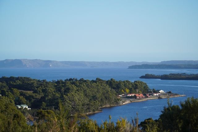
The waterfront and harbour remain central to the visitor experience, while surrounding rainforest and exposed coastal landscapes are only a short drive away.
The weather can shift quickly from still harbour conditions to rain, wind or low cloud, particularly when strong westerly systems move across the region.
How Long Should You Stay in Strahan?
One night is possible, but two nights is more practical for many first-time visitors.
A Gordon River cruise can occupy much of a day, while Ocean Beach, Henty Dunes and shorter local attractions deserve separate time.
Three nights can suit visitors who want a slower pace or who are building flexibility around weather and cruise schedules.
Once your dates are reasonably certain, you can compare accommodation in Strahan and across Tasmania’s West Coast. Location can matter as much as price when you have early cruise departures or a long driving day afterwards.
Macquarie Harbour
Macquarie Harbour is one of the defining geographical features of Tasmania’s West Coast.
The large natural harbour lies between Strahan and the wilderness farther south and east, connected to the Southern Ocean through Hell’s Gates.
For visitors, Macquarie Harbour is much more than the water immediately in front of Strahan.
It provides access to Sarah Island, the Gordon River and a coastline that played an important role in Tasmania’s maritime, convict and industrial history.
The harbour’s scale becomes much easier to understand from the water than from the Strahan waterfront alone.
Experiencing Macquarie Harbour
For most visitors, a commercial cruise from Strahan is the simplest way to experience Macquarie Harbour and continue into the lower Gordon River.
Cruise routes and inclusions vary by operator and may include different combinations of Hell’s Gates, Sarah Island and rainforest landings.
Check current departure times, duration, seating categories and cancellation conditions before organising the rest of the day.
Gordon River
The Gordon River is one of the natural features most closely associated with Strahan and the wider West Coast wilderness.
It flows through the Franklin–Gordon Wild Rivers landscape before entering Macquarie Harbour.
For many visitors, the lower Gordon River is experienced by cruise from Strahan. Tasmania Parks and Wildlife Service specifically notes that Franklin–Gordon Wild Rivers National Park can be accessed via the lower Gordon River on commercial cruise boats from Strahan. 3
Why Does the Gordon River Look So Dark?
The river’s water can appear dark or tea-coloured because of tannins released from surrounding vegetation.
In calm weather, that dark water can produce strong reflections of rainforest and sky, creating the mirror-like photographs often associated with Gordon River cruises.
Those reflections depend on conditions. Wind, rain and river movement can change the surface entirely, so visitors should not expect every cruise to reproduce the same image.
Rainforest Along the Gordon River
Rainforest along the river includes species adapted to Tasmania’s cool, wet western environment.
Huon pine is particularly associated with the region and has played an important role in Tasmania’s industrial and maritime history because of the durability of its timber.
Today, the living forest is part of the protected wilderness that makes the Gordon River experience distinctive.
Sarah Island
Sarah Island sits in Macquarie Harbour and is closely connected with the region’s convict history.
The penal settlement operated during the early nineteenth century in an isolated harbour environment where access was difficult and escape presented obvious challenges.
Today, ruins and archaeological remains help visitors understand the island’s history, while guided interpretation on some cruises provides additional context.
The site should be approached carefully and respectfully rather than as a collection of abandoned structures.
Weather and harbour conditions can affect cruise access, so Sarah Island should be considered part of a broader water-based itinerary rather than something that can always be reached independently on demand.
Hell’s Gates
Hell’s Gates is the narrow entrance connecting Macquarie Harbour with the Southern Ocean.
The name reflects the difficulty and danger historically associated with navigating the entrance rather than describing a modern tourist attraction in isolation.
From a cruise, the passage provides a powerful contrast between the relatively enclosed waters of Macquarie Harbour and the much more exposed Southern Ocean beyond.
Wind, swell and visibility can change the character of the entrance significantly.
Ocean Beach
Ocean Beach, west of Strahan, provides one of the clearest examples of the West Coast’s exposure to the Southern Ocean.
The landscape is very different from the sheltered water around Macquarie Harbour.
Here, visitors encounter long open coastline, strong winds, powerful surf and a horizon with little protection from weather arriving across the ocean.
What to Do at Ocean Beach
- Beach walking
- Photography
- Watching changing weather
- Sunset viewing when conditions are suitable
- Experiencing the exposed western coastline
Ocean Beach should not be treated casually as a swimming beach.
Strong surf, cold water, currents and rapidly changing conditions can create serious hazards. Visitors should remain conservative around the water and avoid approaching the surf simply because the beach appears empty.
Henty Dunes
The Henty Dunes create one of the more unexpected landscapes on the West Coast.
Large expanses of sand sit close to rainforest and the Southern Ocean, creating a dramatic transition between environments.
The dunes are reached between Strahan and Zeehan and can be visited independently or through organised activities depending on what you want to do.
Walking the Dunes
Walking on sand is more physically demanding than walking the same distance on a formed track.
Allow more time than the map suggests, particularly if conditions are windy or the sand is soft.
Sandboarding
Sandboarding is associated with the Henty Dunes and can provide a more active way to experience the landscape.
If hiring equipment or joining an organised activity, check current availability rather than assuming boards will always be available on arrival.
Photography at Henty Dunes
Sand patterns, shadows, vegetation and changing weather create strong photographic possibilities.
Wind can reshape the surface quickly, which means the landscape may look very different after even a short period of unsettled weather.
Hogarth Falls
Hogarth Falls provides an accessible rainforest experience close to Strahan.
The walk begins near town and follows forest beside a creek towards the falls, making it particularly useful for travellers who want a shorter activity without committing to a long drive.
The amount of water flowing over any Tasmanian waterfall varies with recent rainfall, so visitors should expect the appearance of Hogarth Falls to change through the seasons.
Wet timber, rocks and track surfaces can also become slippery after rain.
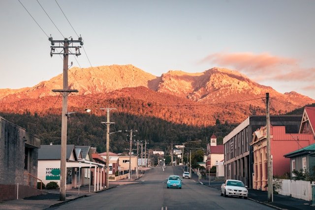
Queenstown
Queenstown is one of the West Coast’s most distinctive towns.
Its identity is inseparable from mining, steep surrounding mountains and the dramatic approach along the Lyell Highway.
The landscape around Queenstown has been heavily influenced by historic mining activity, vegetation clearing, fire and industrial emissions. Some hillsides remain visually different from the dense rainforest found elsewhere on the West Coast, although vegetation has regenerated in many areas over time.
That history makes Queenstown more than a scenic stop. It is a place where natural landscape and industrial heritage sit unusually close together.
What to Do in Queenstown
- Explore the town and its mining heritage
- Visit Spion Kop Lookout
- Drive or stop safely along the Queenstown mountain approaches
- Visit Iron Blow Lookout
- View Horsetail Falls when conditions allow
- Experience the West Coast Wilderness Railway depending on current services
- Use Queenstown as a base for Lyell Highway and Franklin–Gordon exploration
Spion Kop Lookout
Spion Kop provides an elevated view over Queenstown and surrounding mountains.
The lookout is particularly useful for understanding the town’s geography: the compact settlement sits within a much larger mountain landscape shaped by both geology and mining history.
How Long Should You Spend in Queenstown?
A few hours can cover the town and nearby lookouts, but one night provides more time to experience the wider area.
Two nights can make sense if the itinerary includes the railway, several nearby attractions or a slower exploration of the Lyell Highway corridor.
Queenstown can also function as a practical overnight break between the Central Highlands and Strahan.
99 Bends & the Queenstown Road
The winding approach into Queenstown is one of Tasmania’s best-known mountain-road experiences.
Often referred to locally and informally as the 99 Bends, the road twists through steep terrain on the Lyell Highway east of Queenstown.
The exact number of bends is less important than the driving conditions: this is a winding mountain road requiring attention, appropriate speed and respect for weather and other road users.
Do not stop in traffic lanes for photographs.
Use designated lookouts, parking areas or safe pull-offs only.
Driving the 99 Bends Safely
- Slow down before corners rather than braking hard mid-corner.
- Remain within your lane.
- Expect wet roads after rain.
- Allow extra following distance.
- Be prepared for slower vehicles.
- Watch for cyclists and motorcyclists.
- Do not drive according to a navigation app’s theoretical arrival time.
The road is part of the experience, but it should not become a performance. Drive to conditions and let faster traffic pass where safe.
Iron Blow Lookout
Iron Blow Lookout provides a striking view into a former open-cut mining area near Queenstown.
The site helps illustrate the scale of mining that shaped the district and provides context for the altered landscapes visible around the town.
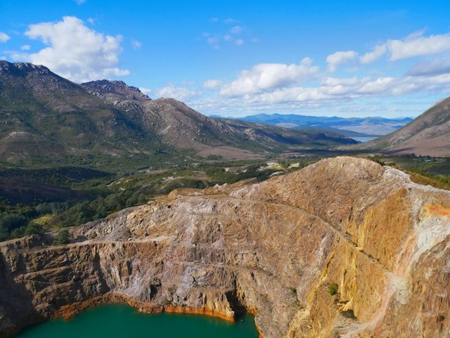
For visitors interested in industrial heritage, the lookout can be more meaningful when combined with time in Queenstown rather than approached only as a colourful roadside photograph.
Stay behind barriers and use the formal viewing area. Historic mining environments may contain unstable ground and other hazards outside managed visitor zones.
Horsetail Falls
Horsetail Falls lies beside the Lyell Highway close to Queenstown and becomes particularly noticeable after rainfall.
Like many West Coast waterfalls, its appearance varies significantly with recent weather.
During drier periods, flow can be reduced. After substantial rain, water can become much more dramatic against the steep surrounding slopes.
The falls are one more reason not to treat rain as automatically negative on a West Coast trip.
West Coast Wilderness Railway
The West Coast Wilderness Railway preserves part of the historic railway system built to connect the Queenstown mining district with the harbour at Strahan.
The railway is particularly significant because of the terrain it crosses. Engineers had to move trains through steep gradients, rainforest and river valleys in a region where road access was historically far more difficult than it is today.
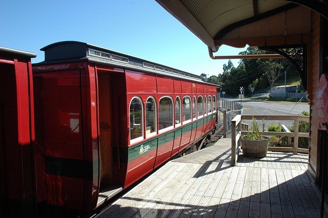
Modern visitor services use restored sections of the railway, but routes, departure points and operating arrangements can change according to maintenance and infrastructure works.
For that reason, do not build the itinerary around an old timetable. Check the current railway operator’s schedule before booking accommodation or planning another major activity on the same day.
Is the Railway Worth Including?
For travellers interested in engineering, railway history, mining heritage or rainforest scenery, the railway can provide useful context that is difficult to obtain simply by driving between Queenstown and Strahan.
It also works well on a day when conditions are less suitable for longer outdoor walks.
However, it is a substantial scheduled experience. If your West Coast stay is short, decide whether the railway or another full-day activity such as a Gordon River cruise is the higher priority rather than assuming both can be squeezed around long drives.
Zeehan
Zeehan lies north of Queenstown and Strahan and provides one of the clearest windows into West Coast mining history.
The town developed during Tasmania’s late nineteenth-century mining boom and once played a much larger role in the region than its present population might suggest.
Today, historic streetscapes, museum collections and surviving buildings help visitors understand how quickly remote West Coast settlements expanded when mineral discoveries attracted investment and workers.
West Coast Heritage Centre
The West Coast Heritage Centre is one of Zeehan’s major attractions and brings together mining, geology, machinery and local history.
Travellers with an interest in the region’s industrial story may want more time here than visitors simply stopping for lunch on the way north.
Why Stop in Zeehan?
Zeehan provides an important contrast with Queenstown.
Both towns were shaped by mining, but their history, scale and surviving built environment are different. Visiting both helps avoid reducing West Coast mining heritage to one town or one landscape.
Rosebery
Rosebery is a working mining town north of Zeehan surrounded by wet forest and mountain scenery.
For visitors, Rosebery is particularly associated with nearby Montezuma Falls and provides services along the road between Zeehan and Tullah.
The town itself remains part of an active industrial landscape rather than being preserved solely for tourism, which is useful context when travelling through the region.
Rosebery can work as a short stop, overnight base or part of a northbound West Coast route.
Tullah & Lake Rosebery
Tullah is a small West Coast settlement beside Lake Rosebery.
The lake and surrounding mountains give the town a very different atmosphere from the historic streets of Zeehan or the harbour setting of Strahan.
Tullah is particularly useful for travellers moving between the northern West Coast and routes towards Cradle Mountain or North West Tasmania.
Water-based activities may be possible according to conditions and local arrangements, while the surrounding landscape can appeal to photographers and travellers seeking a quieter overnight stop.
Montezuma Falls
Montezuma Falls, near Rosebery, is one of Tasmania’s most impressive waterfalls and has long been one of the West Coast’s better-known rainforest walks.
However, visitors need to be aware of a current closure.
Current visitor alert — reviewed August 2026: Tasmania Parks and Wildlife Service states that the Montezuma Falls walking track has been closed since 20 July 2026 because of windfall and a landslip. Access to the southern end of the suspension bridge using the four-wheel-drive track remains available. Check the official alert before travelling because the situation may change after this page is published. 4
Why Is Montezuma Falls Significant?
The waterfall drops through a steep rainforest setting near the former mining district around Williamsford.
The traditional walking route follows an old tramway corridor through wet forest, reflecting the way industrial transport routes have gradually become recreational access into the landscape.
Because closures can last for extended periods after landslips, storms or infrastructure damage, do not rely on an old guidebook or social-media post when planning the walk.
Franklin–Gordon Wild Rivers National Park
Franklin–Gordon Wild Rivers National Park forms one of the most important wilderness landscapes encountered on a West Coast Tasmania road trip.
The park lies within the Tasmanian Wilderness World Heritage Area and protects wild river valleys, rainforest, mountains and remote country extending far beyond the roadside stops visible from the Lyell Highway. 5
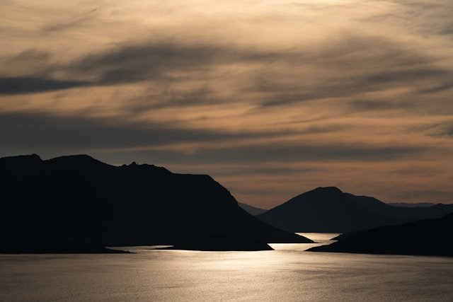
The scale is difficult to appreciate from a map.
Much of the park is genuinely remote, but the Lyell Highway gives ordinary road travellers access to several shorter stops that provide a glimpse into the wider wilderness.
What Can Road-Trippers See?
- Nelson Falls
- Franklin Nature Trail
- Donaghys Hill
- Franklin River and surrounding rainforest
- Mountain views around King William Saddle
Parks also identifies much more demanding routes, including Frenchmans Cap and Lake Rhona, for experienced multi-day walkers. These should not be approached as casual extensions of a roadside itinerary. 6
National Park Pass
A valid Tasmania parks pass is required for entry to Tasmania’s national parks, including Franklin–Gordon Wild Rivers National Park.
Pass types and prices can change, so check current Tasmania Parks and Wildlife Service information rather than relying on a fixed price quoted in an old article.
Nelson Falls
Nelson Falls is one of the easiest and most worthwhile short stops along the Lyell Highway between central Tasmania and Queenstown.
Current Tasmania Parks and Wildlife Service information lists the walk as:
- Distance: 1.4 kilometres return
- Time: approximately 20 minutes return
- Grade: Grade 1
The track runs through cool temperate rainforest to the waterfall and is suitable for a broad range of visitors. Parks notes that the surface is flat and even, with no steep sections, and can be suitable for wheelchair users with assistance. 7
Why Stop at Nelson Falls?
Nelson Falls works particularly well because it breaks up a long driving day without requiring hours of additional hiking.
The forest also provides an immediate contrast with the more open highland landscapes east of the national park and the altered mining landscapes nearer Queenstown.
Waterfall flow varies with recent rainfall, but the West Coast’s wet climate means the forest itself remains an important part of the experience even when flow is lower.
takayna / Tarkine Connections
North of the core Queenstown–Strahan–Zeehan corridor, the landscape gradually connects with the much broader rainforest, river and coastal country commonly referred to as takayna / the Tarkine.
It is useful to treat this as a connected wilderness region rather than assume that every place described as part of takayna / the Tarkine sits within one formally declared national park.
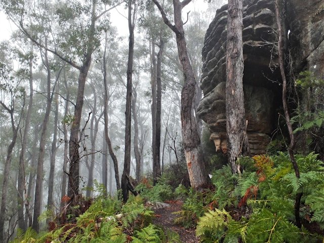
The broader area includes rainforest, buttongrass plains, rivers, coastal landscapes and former mining settlements across north-western Tasmania. For road-trippers, places such as Corinna and the Pieman River can form a natural transition between the West Coast and North West Tasmania.
Corinna & the Pieman River
Corinna is a small former mining settlement beside the Pieman River surrounded by dense forest.
The setting feels noticeably more remote than the larger West Coast towns. River experiences, forest walks and the surrounding landscape can justify staying rather than simply using Corinna as a transit point.
Vehicle access requires more planning than a normal highway journey. Road conditions, ferry arrangements and individual rental-car restrictions should be checked before travelling, particularly if your route includes the Pieman River crossing or unsealed roads.
Should You Add takayna / the Tarkine to a West Coast Trip?
Yes, if you have enough time.
The northern rainforest country fits naturally with a slower West Coast itinerary heading towards Stanley, Burnie, Wynyard or other parts of North West Tasmania.
However, trying to add Corinna, Arthur River and the full Tarkine touring region to an already compressed Queenstown–Strahan itinerary can create a large amount of extra driving.
Travellers with only three days on the West Coast are generally better focusing on Queenstown, Strahan and the Lyell Highway corridor. With five to seven days, the northern rainforest route becomes considerably easier to include.
Best Scenic Drives on West Coast Tasmania
Some of the West Coast’s strongest scenery is experienced from the road.
This does not mean the roads should be driven quickly. Winding corners, wet surfaces, mountain weather, wildlife and frequent stops make the West Coast much better suited to slow touring than to chasing navigation-app arrival times.
The Lyell Highway
The Lyell Highway is one of Tasmania’s most important scenic road-trip corridors.
Approaching from the Central Highlands, the highway passes through Franklin–Gordon Wild Rivers National Park before descending towards Queenstown.
Roadside stops can include the Franklin Nature Trail, Donaghys Hill, Nelson Falls and views across the King William Range and surrounding wilderness.
Tasmania Parks and Wildlife Service currently lists the Franklin Nature Trail at approximately 1 kilometre return, around 25 minutes and Grade 1. Donaghys Hill is currently listed at approximately 2.2 kilometres return, around 40 minutes and Grade 2. Both sit conveniently along the Lyell Highway corridor. 0
The Lyell Highway can occasionally be affected by winter snow, and Parks advises motorists travelling through reserves to avoid unnecessary night driving where possible because native wildlife shares the roads. 1
Queenstown Mountain Approach
The descent towards Queenstown is one of the most visually distinctive sections of road in Tasmania.
Mountain slopes, mining landscapes and the winding highway create a dramatic approach, particularly when low cloud moves across the surrounding peaks.
Use formal lookouts and safe pull-off areas rather than stopping suddenly for photographs.
Queenstown to Strahan
The road between Queenstown and Strahan connects two very different West Coast environments.
Queenstown is surrounded by steep mountain and mining country, while Strahan opens onto Macquarie Harbour and the maritime landscapes of the western coast.
The drive itself is relatively manageable compared with longer cross-island journeys, which is why many itineraries use one town as a base before moving to the other.
Strahan to Zeehan
The route north from Strahan towards Zeehan passes close to Henty Dunes and continues through forest and former mining country.
It is worth allowing enough time for Henty Dunes rather than treating Zeehan as the only destination along the road.
Zeehan to Rosebery and Tullah
Continuing north, the character of the West Coast changes again.
Rainforest becomes increasingly prominent around Rosebery, while Tullah sits beside Lake Rosebery beneath mountain country.
This section is particularly useful for travellers continuing towards Cradle Mountain, North West Tasmania or the northern takayna / Tarkine touring region.
Western Explorer Road
The Western Explorer provides a more remote north-western connection through the broader takayna / Tarkine region.
It should not be approached like a conventional sealed highway. Sections are unsealed, services are limited and road conditions can vary substantially after severe weather.
If you plan to use this route, check current road conditions, fuel range, weather and rental-vehicle restrictions before leaving the main highway network.
A normal road-trip itinerary should never assume that an unsealed remote road remains in the same condition throughout the year.
Walks & Outdoor Experiences on West Coast Tasmania
The West Coast offers everything from short rainforest walks beside highways to demanding multi-day wilderness journeys.
This range makes it especially important to distinguish between accessible roadside experiences and serious remote bushwalking.
Nelson Falls
Nelson Falls is one of the most accessible choices, with the current Parks listing of 1.4 kilometres return, approximately 20 minutes and Grade 1.
It is particularly useful for breaking the Lyell Highway journey while still experiencing West Coast rainforest.
Franklin Nature Trail
The Franklin Nature Trail is another easy road-trip stop within Franklin–Gordon Wild Rivers National Park.
Parks currently lists the walk at approximately 1 kilometre return, around 25 minutes and Grade 1. The route leads through mossy rainforest towards the Franklin River. 2
One current operational detail is worth knowing: Parks presently advises that toilets at the Franklin River Nature Trail are closed, with alternatives at Nelson Falls and Derwent Bridge. Because this type of facility information can change, check current Parks notices before relying on it. 3
Donaghys Hill
Donaghys Hill provides a longer but still relatively accessible walk from the Lyell Highway.
The current Parks listing is approximately 2.2 kilometres return, around 40 minutes and Grade 2. In clear weather, the lookout provides views over the Franklin River valley and towards Frenchmans Cap and neighbouring peaks. 4
The walk is in a Fuel Stove Only Area and fires are prohibited.
Hogarth Falls
Hogarth Falls provides a shorter forest walk close to Strahan and is useful for travellers who want an activity that does not require another substantial drive.
Montezuma Falls
Montezuma Falls has traditionally been one of the best-known rainforest walks near Rosebery, but the walking track is currently closed because of windfall and a landslip.
Do not build an itinerary around the standard walking route until Tasmania Parks and Wildlife Service confirms that it has reopened.
Frenchmans Cap
Frenchmans Cap is in an entirely different category from the short highway walks.
Tasmania Parks and Wildlife Service currently lists the route as approximately 54 kilometres return, 3–5 days and Grade 4. It is a remote multi-day wilderness walk requiring appropriate experience, equipment and preparation. 5
Do not add Frenchmans Cap casually to a normal West Coast sightseeing itinerary simply because the mountain is visible from roadside areas.
Lake Rhona
Lake Rhona is another remote walk inside Franklin–Gordon Wild Rivers National Park.
Current Parks information describes the route as approximately 28 kilometres return over 2–3 days, Grade 4, and visitors must currently register for the walk. The route begins and ends with a crossing of the Gordon River. 6
This is not a casual overnight walk. River conditions, weather, navigation, equipment and wilderness experience all matter.
Mount McCall 4WD Track
Experienced four-wheel-drive travellers may also encounter the Mount McCall Track within Franklin–Gordon Wild Rivers National Park.
Parks currently lists it as a 44-kilometre return medium-rated 4WD route suitable for four-wheel-drive vehicles and trail bikes only. The track is gated and requires a key from the local Parks and Wildlife Service office. 7
This is a specialist off-road experience rather than a road suitable for an ordinary rental car.
Choosing the Right West Coast Walk
- For an easy rainforest walk: Nelson Falls or Franklin Nature Trail.
- For a slightly longer roadside walk: Donaghys Hill.
- For a short Strahan activity: Hogarth Falls.
- For experienced multi-day walkers: Frenchmans Cap or Lake Rhona, subject to current conditions and requirements.
- For Montezuma Falls: check the current closure before travelling.
Conditions in western Tasmania can change at any time of year. Choose walks according to your actual experience and the current weather rather than simply their popularity.
Wildlife on West Coast Tasmania
West Coast Tasmania contains large areas of forest, moorland, river country and relatively low-density settlement, creating habitat for a wide range of native wildlife.
Visitors may see wallabies, pademelons, wombats, possums and numerous bird species, although sightings vary by habitat, season and time of day.
Wildlife and Driving
The most important wildlife issue for most road-trippers is road safety.
Animals are especially active around dawn, dusk and at night, and visibility can already be reduced by rain, fog and winding roads.
Tasmania Parks and Wildlife Service advises avoiding night driving in reserves where possible and reminds visitors that native wildlife shares these roads. 8
If you must drive in low light, slow down and remain prepared for animals to enter the road unexpectedly.
Marine Wildlife Around Strahan
Macquarie Harbour and the coastal environment around Strahan also support marine and birdlife.
Wildlife sightings from cruises or shore should always be treated as a bonus rather than a guaranteed component of the day.
Birdlife
Rainforest, wetlands, rivers and coast support a broad range of bird species.
Travellers interested in birdwatching will generally have better results by spending time quietly in suitable habitat rather than expecting birds to appear around busy roadside lookouts.
Best Time to Visit West Coast Tasmania
The West Coast can be visited throughout the year, but the experience changes substantially with the seasons.
This region receives much more rainfall than Tasmania’s sheltered east, and rain should be considered part of the normal environment rather than an unusual disruption.
Summer: December to February
Summer provides long daylight hours, making it particularly useful for road trips, walking and combining several stops within one day.
Conditions can be milder than winter, but rain, strong wind and cool changes remain possible.
Summer is also a popular period, so accommodation and major scheduled experiences such as cruises may deserve earlier booking.
Autumn: March to May
Autumn can work very well for West Coast road trips.
Daylight gradually shortens and nights become cooler, but the region remains suitable for waterfalls, forest walks, photography and town-based exploration.
Winter: June to August
Winter can produce some of the West Coast’s most dramatic conditions.
Mountain snow, low cloud, heavy rain and mist can make the landscape especially atmospheric, but these conditions also require greater flexibility.
The Lyell Highway may occasionally be affected or closed by snow, according to Tasmania Parks and Wildlife Service. 9
Check weather and road information before leaving accommodation rather than assuming a route remains open because conditions are mild in Strahan or Hobart.
Spring: September to November
Spring brings increasing daylight and fresh vegetation but remains highly changeable.
Waterfalls can be particularly rewarding after sustained rainfall, while the longer days make it easier to connect Queenstown, Strahan and northern West Coast towns.
Is There a Best Season?
Not universally.
Summer offers the most daylight. Winter provides dramatic weather and often stronger waterfall flow. Autumn and spring can provide a useful balance for road trips.
The West Coast rewards visitors who arrive prepared for changing conditions rather than expecting a guaranteed weather pattern.
Where to Stay on West Coast Tasmania
Choosing accommodation well can reduce unnecessary driving and make the West Coast significantly easier to explore.
Strahan
Strahan is the strongest base for Gordon River cruises, Macquarie Harbour, Ocean Beach, Henty Dunes and local walks.
Two nights works particularly well when a full-day cruise is part of the itinerary.
Queenstown
Queenstown suits travellers interested in mining heritage, scenic drives, the West Coast Wilderness Railway and the Lyell Highway corridor.
It can also provide a convenient break between the Central Highlands and Strahan.
Zeehan
Zeehan can be useful for travellers continuing north and those especially interested in mining history.
Rosebery
Rosebery is practical for travellers moving through the northern West Coast and traditionally provided convenient access to Montezuma Falls, although the standard walking track is currently closed.
Tullah
Tullah can suit visitors wanting a quieter stay beside Lake Rosebery or travellers transitioning towards Cradle Mountain and North West Tasmania.
Once your route is settled, you can compare accommodation across Tasmania’s West Coast and judge options according to the following day’s activities rather than price alone.
Should You Change Accommodation Every Night?
Not necessarily.
A useful first-time approach is two nights in Strahan and one or two nights around Queenstown or the northern West Coast.
Changing accommodation every evening may look efficient on a map but can create unnecessary packing and driving in a region where weather already adds uncertainty.
Camping & Campervan Travel on the West Coast
The West Coast suits campervan and camping travel, but travellers should distinguish between formal campgrounds, national-park camping and places where overnight camping is not permitted.
Do not assume that an isolated roadside pull-off or scenic parking area is automatically a legal campsite.
Campground access, fees and facilities vary widely. Some locations may have basic toilets while others require visitors to be substantially more self-sufficient.
Travellers planning a broader camping journey around Tasmania may find an Australian camping and road-trip guide useful when researching legal overnight stops. Always confirm the current rules with the relevant land manager before camping.
Fire Restrictions
Several West Coast wilderness areas are Fuel Stove Only Areas, including locations within Franklin–Gordon Wild Rivers National Park where open fires are prohibited. 10
Check current fire restrictions before travelling and carry appropriate cooking equipment rather than assuming a campfire will be permitted.
Mobile Coverage, Fuel & Services
The West Coast contains long stretches of road between towns, so ordinary practical planning becomes more important than in Tasmania’s major cities.
Mobile Coverage
Mobile coverage is generally stronger around towns than in mountain, rainforest and remote road corridors.
Download offline maps, save accommodation addresses and keep essential booking information available without relying on a mobile signal.
International travellers who want mobile data can check eSIM options for Australia before travelling. An eSIM does not remove physical network black spots, so offline navigation remains important.
Fuel
Fuel is available in larger West Coast towns, but it is sensible not to let the tank become unnecessarily low.
This is particularly important before remote northern routes or after-hours travel when smaller service stations may not operate continuously.
Food & Supplies
Strahan and Queenstown provide useful services, while smaller towns have more limited choices.
If you are camping, walking remotely or driving into less populated northern areas, carry enough food and water to avoid relying on one business being open.
West Coast Tasmania Itineraries
The West Coast is one of the regions where adding more time usually improves the trip more than adding more attractions.
Three days provides an introduction. Five days offers a much more balanced journey. Seven days allows the region to be explored at a genuinely slower pace and makes northern extensions considerably easier.
3-Day West Coast Tasmania Itinerary
Three days should focus on the core Queenstown–Strahan corridor rather than attempting the entire western side of Tasmania.
- Day 1 – Central Highlands to Queenstown: Travel west along the Lyell Highway. Stop at Franklin Nature Trail, Nelson Falls or Donaghys Hill according to available time. Explore Queenstown and nearby lookouts before staying locally or continuing to Strahan.
- Day 2 – Strahan: Choose a Gordon River and Macquarie Harbour cruise as the main scheduled experience. Spend the evening around Strahan.
- Day 3 – Strahan, Henty Dunes & Zeehan: Visit Ocean Beach or Henty Dunes, then continue north towards Zeehan or return according to the wider itinerary.
Trying to add Cradle Mountain, Corinna, the Tarkine and several remote walks to these three days would create a very rushed trip.
5-Day West Coast Tasmania Itinerary
Five days provides enough time to experience the major towns and wilderness without making every day a long drive.
- Day 1 – Lyell Highway & Queenstown: Travel through Franklin–Gordon Wild Rivers National Park, stopping at Nelson Falls and another short walk if conditions allow.
- Day 2 – Queenstown: Explore mining heritage, Iron Blow, the 99 Bends area and, depending on current operations, the West Coast Wilderness Railway.
- Day 3 – Strahan: Spend a full day on Macquarie Harbour and the Gordon River.
- Day 4 – Strahan & Henty Dunes: Explore Hogarth Falls, Ocean Beach and the Henty Dunes without rushing.
- Day 5 – Zeehan, Rosebery & Tullah: Travel north through the mining towns and rainforest country before continuing towards North West Tasmania or Cradle Mountain.
Because Montezuma Falls is currently closed via the standard walking track, do not allocate several hours to that walk unless Parks confirms it has reopened.
7-Day West Coast Tasmania Itinerary
Seven days allows the West Coast to feel like a destination rather than a corridor between Hobart and Cradle Mountain.
- Day 1 – Central Highlands to Queenstown: Explore the Lyell Highway wilderness corridor.
- Day 2 – Queenstown: Mining history, lookouts, railway or a slower day around town.
- Day 3 – Strahan: Gordon River cruise, Sarah Island and Macquarie Harbour.
- Day 4 – Strahan surroundings: Ocean Beach, Henty Dunes, Hogarth Falls and waterfront time.
- Day 5 – Zeehan & Rosebery: Explore the West Coast Heritage Centre and continue north.
- Day 6 – Tullah or Corinna: Slow the journey around Lake Rosebery or extend towards Corinna and the Pieman River if road and ferry arrangements suit.
- Day 7 – Continue north: Move into North West Tasmania, Cradle Mountain or the broader takayna / Tarkine touring area.
West Coast Tasmania from Hobart
A geographically sensible route is:
Hobart → Central Highlands → Franklin–Gordon Wild Rivers → Queenstown → Strahan → Zeehan → Rosebery → Tullah → North West Tasmania.
This works particularly well as part of a larger clockwise Tasmania circuit.
West Coast Tasmania to Cradle Mountain
Travellers often continue from Tullah or the northern West Coast towards Cradle Mountain.
For site structure and trip planning, continue with our dedicated Cradle Mountain Travel Guide rather than treating Cradle Mountain as simply another West Coast attraction.
If you are still deciding how the West Coast should fit within the whole island itinerary, use our complete guide to planning a trip to Tasmania.
Road & Weather Safety on West Coast Tasmania
Road safety deserves more attention on the West Coast than it does in many ordinary destination guides.
The combination of winding mountain roads, rain, fog, wildlife, winter ice and long distances between services can make a journey more demanding than the kilometre count suggests.
Allow More Time Than Navigation Apps Suggest
A navigation app estimates driving time. It does not include waterfall stops, roadworks, slow vehicles, poor visibility, wildlife or the fact that you may want to stop repeatedly for scenery.
Build substantial spare time into West Coast driving days.
Rain
Rain is normal on the West Coast.
Wet roads require lower speeds and greater braking distance, particularly around Queenstown’s mountain bends and narrow rural sections.
Fog & Low Cloud
Visibility can fall quickly in mountain country.
Use headlights as required, reduce speed and avoid following another vehicle too closely simply because its lights provide a visual reference.
Snow & Ice
Higher sections of the Lyell Highway can be affected by snow and ice during colder weather.
Parks currently warns that the highway may occasionally close because of snow in winter. 11
Check current road information before departing rather than attempting to assess conditions only after reaching higher country.
Wildlife
Dawn, dusk and nighttime driving increase the likelihood of encountering wildlife.
Where possible, plan accommodation so major driving is completed in daylight.
Unsealed Roads
If your route includes Corinna, the Western Explorer or another unsealed road, check conditions and your rental agreement beforehand.
An ordinary passenger car being physically capable of travelling on a road does not mean the rental company permits it.
Do Not Stop in Traffic Lanes for Photos
The Queenstown approaches and Lyell Highway provide many tempting views.
Wait for a formal lookout or safe parking area instead of stopping suddenly on a bend or road shoulder.
Practical West Coast Tasmania Travel Tips
1. Give the West Coast More Than One Night
A single night usually means most of the visit is spent driving.
Three days provides a basic introduction; five days is considerably more comfortable.
2. Treat the Drive as Part of the Trip
Nelson Falls, Franklin Nature Trail, Donaghys Hill and the mountain approach to Queenstown are not interruptions to the journey. They are part of the West Coast experience.
3. Carry Waterproof Clothing
A waterproof outer layer is useful in every season.
Do not depend on one morning forecast to remain accurate throughout an entire mountain or coastal day.
4. Download Offline Maps
Mobile reception may weaken outside towns.
Keep offline navigation available before entering remote areas.
5. Fuel Before Remote Sections
Do not rely on the next small settlement always providing fuel at the exact time you arrive.
6. Check Montezuma Falls Before Travelling
The standard walking track is currently closed. Check the Parks alert before including it in your itinerary.
7. Book Scheduled Experiences Carefully
A Gordon River cruise or railway experience can occupy a substantial part of the day.
Avoid booking them immediately before or after a long cross-region drive if you can.
8. Keep One Flexible Weather Window
If you have several days, avoid locking every outdoor activity to one specific hour.
Weather flexibility can significantly improve the experience.
9. Carry Food and Water on Long Driving Days
Roadside cafés and shops are not distributed continuously across the West Coast.
10. Respect Remote Wilderness
Short roadside walks and multi-day wilderness routes are very different experiences.
Choose remote routes only with the preparation appropriate to their difficulty.
Frequently Asked Questions About West Coast Tasmania
How many days do you need on West Coast Tasmania?
Three days provides an introduction to Queenstown and Strahan. Five days is considerably better for including wilderness stops, Zeehan and the northern towns. Seven days allows a slower itinerary and makes Corinna or the broader takayna / Tarkine region easier to include.
Is West Coast Tasmania worth visiting?
For travellers interested in wilderness, rainforest, wild rivers, mining heritage, scenic roads and dramatic weather, the West Coast provides one of Tasmania’s most distinctive regional experiences.
What are the main towns on West Coast Tasmania?
For visitor planning, the core towns include Queenstown, Strahan, Zeehan, Rosebery and Tullah. Corinna can also be incorporated into a broader northern West Coast itinerary.
Should I stay in Queenstown or Strahan?
They serve different purposes. Strahan is more convenient for Gordon River cruises, Macquarie Harbour, Ocean Beach and Henty Dunes. Queenstown is better positioned for mining heritage, the Lyell Highway, Iron Blow and railway experiences. Many itineraries benefit from spending time in both.
Is Strahan worth staying for two nights?
Yes. A Gordon River cruise can occupy most of one day, leaving another day for Ocean Beach, Henty Dunes, Hogarth Falls and the town itself.
How long is the drive from Hobart to West Coast Tasmania?
The exact time depends on your destination, road conditions and stops. Queenstown and Strahan should both be treated as substantial driving journeys from Hobart rather than short transfers. Allow extra time for the Lyell Highway’s mountain roads and worthwhile wilderness stops.
Can you visit Strahan as a day trip from Hobart?
It is technically possible to drive long distances in a day, but a return day trip would involve too much road time for most travellers to experience Strahan properly. An overnight stay is much more practical.
Is Queenstown worth visiting?
Yes, particularly for travellers interested in Tasmania’s mining history, dramatic mountain roads and industrial landscapes. Queenstown provides a very different experience from Strahan and the East Coast.
Is the Gordon River worth visiting?
The Gordon River is one of the defining wilderness experiences associated with Strahan. Commercial cruises provide the easiest visitor access to the lower river and often combine it with Macquarie Harbour and other historic sites.
Can you drive to the Gordon River?
The lower Gordon River is primarily experienced from the water rather than by ordinary road access. Franklin–Gordon Wild Rivers National Park can also be experienced from the Lyell Highway through separate roadside walks and viewpoints.
Is Montezuma Falls open?
At the latest review in August 2026, the standard Montezuma Falls walking track remains closed following windfall and a landslip. Check Tasmania Parks and Wildlife Service for the latest status before travelling.
How long is Nelson Falls walk?
Current Parks information lists Nelson Falls at approximately 1.4 kilometres return, around 20 minutes and Grade 1.
How long is Donaghys Hill walk?
Parks currently lists Donaghys Hill at approximately 2.2 kilometres return, around 40 minutes and Grade 2. 12
How long is Franklin Nature Trail?
The Franklin Nature Trail is currently listed at approximately 1 kilometre return, around 25 minutes and Grade 1. 13
Do you need a parks pass for Franklin–Gordon Wild Rivers National Park?
Yes. A valid Tasmania parks pass is required for entry to Tasmania’s national parks, including Franklin–Gordon Wild Rivers National Park. 14
Does it snow on West Coast Tasmania?
Snow can affect higher elevations and mountain roads, particularly during winter. Parks advises that the Lyell Highway may occasionally close because of snow. 15
Does it rain a lot on West Coast Tasmania?
The western side of Tasmania receives substantial rainfall because of its exposure to westerly weather systems. Rain is a normal part of the region’s climate and supports its rivers, rainforest and waterfalls.
Can you visit West Coast Tasmania in winter?
Yes. Winter can provide dramatic scenery, waterfalls and quieter towns, but itineraries need greater flexibility because of shorter daylight, snow, ice, rain and possible road disruptions.
Do you need a 4WD for West Coast Tasmania?
No. A normal road vehicle is suitable for the major highways and principal towns. A 4WD is required for specialist tracks such as Mount McCall and may be useful on some remote routes, but these are not necessary for an ordinary West Coast itinerary.
Can you drive the Western Explorer in a normal car?
The Western Explorer includes unsealed road sections. Vehicle suitability depends on current road conditions and your rental agreement. Check both before travelling rather than assuming permission or suitability.
Is Cradle Mountain on the West Coast?
Cradle Mountain is at the northern end of Cradle Mountain–Lake St Clair National Park and is often included in broader western Tasmania itineraries. For practical trip planning, Island Files Tasmania treats it separately through our Cradle Mountain guide rather than presenting it as a core West Coast town or attraction.
Can you combine West Coast Tasmania and Cradle Mountain?
Yes. A common route travels north through Queenstown, Zeehan, Rosebery and Tullah before continuing towards Cradle Mountain. Allow enough time because mountain weather and walking plans can affect the schedule.
Can you combine West Coast and North West Tasmania?
Yes. The northern West Coast connects naturally with North West Tasmania, particularly for travellers continuing towards the takayna / Tarkine region, Burnie, Wynyard or Stanley.
Is West Coast Tasmania suitable for families?
Yes, provided activities are chosen appropriately. Short walks such as Nelson Falls, railway experiences, Strahan and selected lookouts can work well for families. Long wilderness walks, exposed beaches and remote 4WD routes require very different preparation.
Does West Coast Tasmania have mobile reception?
Coverage is generally stronger in towns and can become unreliable on remote highways, in rainforest and mountain areas. Download offline navigation before leaving major settlements.
Explore West Coast Tasmania Without Rushing It
West Coast Tasmania is difficult to understand through a list of attractions alone.
The Gordon River matters, but so does the journey across Macquarie Harbour to reach it. Queenstown’s mining landscape is distinctive, but its meaning becomes clearer when compared with the rainforest only a short distance away. Nelson Falls is a short walk, yet it can become one of the most memorable stops on the long road west. Strahan is a small town, but the harbour beyond it opens into a much larger wilderness story.
The region works best when there is enough time to accept its weather rather than fight it.
Rain may change a walking plan. Fog may obscure a mountain view. A waterfall may become stronger overnight. A calm Gordon River cruise may look completely different from one taken during unsettled conditions.
That variability is part of travelling western Tasmania.
If you are continuing north, use our North West Tasmania Travel Guide or our dedicated Cradle Mountain guide. If you are approaching from the east, our Central Highlands Tasmania guide can help connect the journey towards Hobart.
For the broader island-wide route, return to our Travel Tasmania pillar guide. If you are still deciding how many regions to include, use our complete Tasmania trip planning guide.
Planning note: West Coast road conditions, weather, walking-track access, national park requirements, cruise schedules, railway services, ferry arrangements and campground conditions can change. Check current official information before departure, particularly before undertaking remote walks, using unsealed roads, travelling in winter or visiting an attraction affected by a closure.