
Tasmania’s Central Highlands reveal a very different side of the island. Away from the major cities and coastlines, the landscape rises into an extensive interior of lakes, open plateau, alpine vegetation, historic settlements, trout waters, hydro-electric infrastructure and some of Tasmania’s most remote wilderness.
This is a region where the journey often becomes part of the destination. Roads climb from farmland into exposed high country, lakes appear across the plateau, weather can change rapidly and relatively small distances can lead from heritage towns to places that feel genuinely isolated.
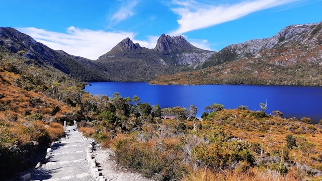
Bothwell provides one of the most accessible introductions to the region, with historic streets and strong connections to Tasmania’s early inland settlement. Further north and west, Great Lake, Miena and the Central Plateau form the heart of Tasmania’s highland lake country. Walls of Jerusalem National Park protects a much more remote alpine landscape accessible primarily on foot, while Lake St Clair sits at an important transition between the Central Highlands and the wilderness of western Tasmania.
The Central Highlands is also a region where Tasmania’s natural and industrial histories meet. Lakes and rivers that had shaped the landscape for thousands of years later became central to the state’s hydro-electric development. Settlements such as Tarraleah, together with dams, canals, pipelines and power infrastructure across the highlands, help tell that engineering story.
Planning a Central Highlands Tasmania road trip requires more flexibility than many coastal itineraries because weather, road conditions and distances can affect your day.
This complete Central Highlands Tasmania travel guide brings those landscapes together. It covers the major towns, lakes, national parks, scenic roads, walking opportunities, fishing, hydro heritage, wildlife, weather, accommodation, itineraries and practical travel considerations for exploring Tasmania’s interior.
If the Central Highlands is only one part of your Tasmania holiday, begin with our Travel Tasmania guide to understand how the island’s regions connect. If you are still deciding how long to stay, which regions to choose and how to build a realistic driving route, use our complete Tasmania trip planning guide.
Jump to Central Highlands Tasmania
- Central Highlands Tasmania Overview
- Where Are Tasmania’s Central Highlands?
- Why Visit the Central Highlands?
- Getting to the Central Highlands
- Bothwell
- Great Lake
- Miena
- Liawenee
- Central Plateau Conservation Area
- Pine Lake
- Walls of Jerusalem National Park
- Highland Lakes
- Arthurs Lake
- Little Pine Lagoon
- Tarraleah
- Derwent Bridge
- Lake St Clair
- Cradle Mountain Connection
- Hydro-Electric Heritage
- Trout Fishing
- Walking & Hiking
- Wildlife
- Scenic Drives
- Central Highlands Road Trip
- Best Time to Visit
- Central Highlands in Winter
- Where to Stay
- Camping & Campervans
- Fuel, Food & Mobile Coverage
- Suggested Itineraries
- Connecting with Other Tasmania Regions
- Road & Walking Safety
- Practical Travel Tips
- Frequently Asked Questions
Central Highlands Tasmania Overview
Tasmania’s Central Highlands occupy much of the island’s elevated interior.
There is no single tourism boundary that every organisation uses in exactly the same way, so Island Files Tasmania treats the Central Highlands as a practical travel-planning region rather than a rigid administrative boundary.
For travellers, the region includes the historic district around Bothwell, Great Lake and the Highland Lakes, the Central Plateau, Walls of Jerusalem National Park and important western highland destinations around Tarraleah, Derwent Bridge and Lake St Clair.
This interpretation also explains why some destinations naturally overlap neighbouring regions. Lake St Clair lies within Cradle Mountain–Lake St Clair National Park and acts as a transition towards West Coast Tasmania. Cradle Mountain sits at the northern end of the same national park but is better treated through its own Cradle Mountain travel guide rather than being presented as a nearby Central Highlands roadside attraction.
The Central Highlands landscape is generally higher, colder and more exposed than Tasmania’s major coastal population centres. Moorlands, wetlands, lakes and rocky plateaus occur across large areas, while weather can become severe during any season.
Tasmania Parks and Wildlife Service describes the Central Plateau Conservation Area as a wild sub-alpine environment containing a remarkable concentration of tarns and lakes. The area sits on the northern edge of the Tasmanian Wilderness World Heritage Area and is sometimes referred to as the “land of a thousand lakes.”
That sense of space is central to the region’s appeal. Unlike Hobart, Launceston or the more concentrated visitor destinations along the East Coast, the Central Highlands rewards travellers who enjoy driving, landscape photography, fishing, walking and quieter places.
Where Are Tasmania’s Central Highlands?
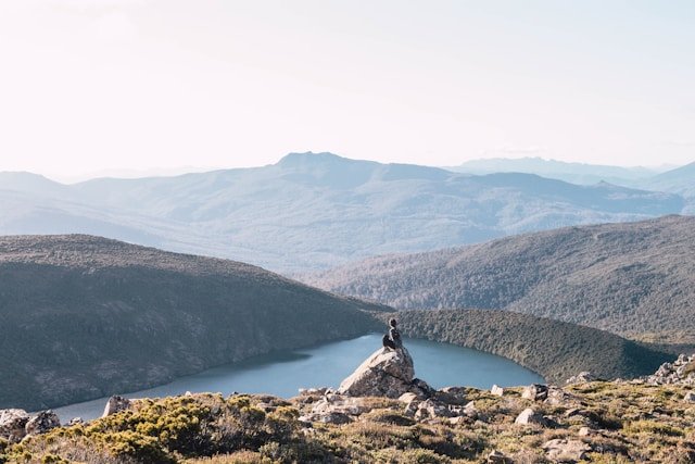
The Central Highlands occupy a broad section of central Tasmania between the island’s more populated eastern, northern and southern districts and the mountainous wilderness of the west.
There are several ways to enter the region.
From Hobart, travellers can approach Bothwell before climbing towards Great Lake and the Central Plateau. Another important route follows the Lyell Highway west through the Derwent Valley towards Ouse, Tarraleah, Derwent Bridge and Lake St Clair.
From Launceston and North Tasmania, routes climb towards the Great Western Tiers and the Highland Lakes Road, providing access to Great Lake, Pine Lake and the northern Central Plateau.
From western Tasmania, the Lyell Highway connects Queenstown and the Franklin–Gordon wilderness corridor with Lake St Clair and the highlands.
These multiple approaches make the Central Highlands particularly useful within a circular Tasmania road trip. Rather than entering and leaving through the same road, visitors can cross the island’s interior while connecting South Tasmania, North Tasmania or the West Coast.
Why Visit the Central Highlands?
The Central Highlands appeals most strongly to travellers wanting to experience Tasmania beyond its coastline and major towns.
For first-time visitors, Central Highlands Tasmania offers a striking contrast to Hobart, the East Coast and Tasmania’s northern coastal regions.
A Landscape of Lakes
Water is one of the region’s defining features.
Great Lake is the most obvious large lake for road travellers, but the wider plateau contains hundreds of smaller lakes, lagoons, tarns, reservoirs and wetlands.
Some are accessible by normal roads. Others require unsealed-road travel, four-wheel-drive access or substantial bushwalking.
Tasmania’s High Country
The landscape can feel dramatically different from the beaches around Freycinet National Park or the granite coastline around the Bay of Fires.
Low alpine vegetation, exposed rock, broad lake surfaces and distant peaks become more prominent as elevation increases.
Cloud and weather also influence the experience. Clear conditions can create expansive views across the plateau, while mist, frost or snow can make the same place feel much more remote.
Historic Towns
Not every Central Highlands experience involves wilderness.
Bothwell provides an accessible heritage destination with sandstone buildings, early colonial streetscapes and a strong historical association with Scottish settlers.
Tarraleah and other former hydro settlements tell a later story about the engineering projects that changed Tasmania during the twentieth century.
Trout Fishing
The Central Highlands is internationally recognised within trout-fishing circles.
Fishing has long been closely associated with Central Highlands Tasmania, particularly around its extensive network of lakes and waterways.
Great Lake, Arthurs Lake, Little Pine Lagoon and many other waters support established recreational fisheries, although regulations vary from water to water.
Wilderness Walking
Walls of Jerusalem National Park and the broader plateau provide some of Tasmania’s most significant alpine walking environments.
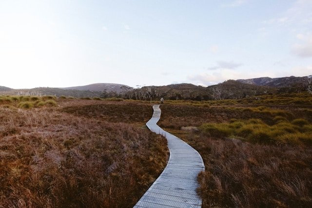
These are not extensions of an ordinary sightseeing day. Some routes involve remote terrain, rapidly changing weather, navigation and overnight self-sufficiency.
Getting to the Central Highlands
From Hobart
Hobart provides one of the most convenient starting points for southern Central Highlands travel.
For Great Lake and Bothwell, travellers can move north-west through the southern inland districts before climbing towards the plateau.
For Lake St Clair and western highland country, the Lyell Highway provides the principal route through the Derwent Valley and onwards towards Tarraleah and Derwent Bridge.
If your journey begins with several days around Hobart, see our dedicated Hobart travel guide and broader South Tasmania Travel Guide before continuing inland.
From Launceston
Launceston provides a convenient northern approach to the Central Highlands.
Routes through the Great Western Tiers can connect northern Tasmania with Pine Lake, Great Lake and the wider Highland Lakes region.
This can create an interesting alternative to travelling directly south along the Midlands Highway.
If your journey begins around Launceston, combine this page with our Launceston guide and North Tasmania Travel Guide.
From West Coast Tasmania
The Lyell Highway creates the major road connection between the highlands and western Tasmania.
Travellers moving east from Queenstown pass through Franklin–Gordon Wild Rivers National Park before reaching Lake St Clair, Derwent Bridge and highland country.
The reverse direction creates an equally strong transition from open inland landscapes into increasingly wet and mountainous western Tasmania.
Continue planning that section with our West Coast Tasmania Travel Guide.
Do You Need a Car?
For most independent visitors, a vehicle is the most practical way to explore the Central Highlands.
Public transport is limited compared with Tasmania’s cities, and many lakes, small settlements, walks and scenic roads are difficult to reach without independent transport.
Driving through Central Highlands Tasmania is often part of the experience, with routes passing lakes, open plateau country, historic settlements and mountain landscapes.
If you are flying into Tasmania and need a vehicle, you can compare car rental options in Tasmania. Check insurance, unsealed-road restrictions and one-way fees before booking.
Bothwell
Bothwell is one of the most accessible and historically interesting towns in Tasmania’s Central Highlands.
The settlement developed during the early nineteenth century and retains a substantial collection of heritage buildings. Its sandstone architecture, churches and streetscapes provide a gentle introduction to the region before the roads climb into higher and more exposed country.
Official Tasmania tourism information identifies more than 50 heritage-listed buildings in Bothwell.
Things to Do in Bothwell
- Walk through the heritage town centre.
- See historic sandstone buildings.
- Visit the Australasian Golf Museum.
- Explore the town’s Scottish heritage.
- Visit local parks and heritage streets.
- Use Bothwell as a southern gateway to Great Lake.
- Explore parts of the Highlands Power Trail.
Golf History
Bothwell has an unusual connection with the early history of golf in Australia.
The course at Ratho Farm dates to the mid-1830s and is widely regarded as Australia’s oldest golf course.
The connection reflects the Scottish influence of early settlers in this part of Tasmania.
How Long Do You Need in Bothwell?
A few hours is enough for a first look around town.
An overnight stay can make sense for travellers who prefer slower heritage travel or want an early start towards Great Lake the following morning.
Great Lake Tasmania
Great Lake is one of the defining landscapes of the Central Highlands.
Situated at high elevation on Tasmania’s Central Plateau, the lake is surrounded by an exposed environment that can feel substantially colder and more remote than towns at lower elevations.
Great Lake has long been associated with trout fishing and hydro-electric development, but visitors do not need to be anglers to appreciate the landscape.
The Highland Lakes Road follows sections of the eastern shore, allowing road travellers to experience the lake without requiring a remote wilderness expedition.
Things to Do Around Great Lake
- Drive the Highland Lakes Road.
- Photograph the highland landscape.
- Fish where licensed and permitted.
- Explore Miena and other lakeside communities.
- Visit nearby lakes and lagoons.
- Use the lake as part of a north-south highlands road trip.
Great Lake should not be approached as though it were a conventional resort lake with continuous tourist infrastructure around its shoreline.
Its appeal is largely the open highland setting, fishing culture, weather and sense of space.
Miena
Miena is one of the principal communities beside Great Lake and a useful base for exploring the Highland Lakes.
It is a small highland settlement rather than a large tourism town. Accommodation, food and other services are more limited than in Hobart or Launceston, so planning ahead can be useful.
For anglers, Miena provides practical access to several well-known trout waters.
For non-anglers, it offers the opportunity to experience the highlands at different times of day. Morning frost, low cloud, evening light and sudden weather changes can transform the same landscape within hours.
If you intend to stay around Great Lake, you can compare accommodation options for your Tasmania trip before finalising the rest of the route.
Liawenee
Liawenee sits on the western side of Great Lake and is closely associated with Tasmania’s inland fisheries and highland environment.
For ordinary travellers, the settlement is small and facilities should not be assumed. Its importance is primarily connected with Great Lake, fisheries management and access towards parts of the Central Plateau.
The surrounding landscape is particularly exposed, and winter conditions can be severe.
If you are continuing west from Liawenee towards the interior of the Central Plateau, the journey changes from normal scenic touring into increasingly remote travel requiring more preparation.
Central Plateau Conservation Area
The Central Plateau Conservation Area protects a vast highland environment of sub-alpine moorland, lakes and tarns on the northern edge of the Tasmanian Wilderness World Heritage Area.
Tasmania Parks and Wildlife Service describes it as an isolated landscape between Great Lake to the east and Walls of Jerusalem National Park to the west.
The Highland Lakes Road forms the main accessible eastern route, but much of the interior is considerably more remote.
The Land of a Thousand Lakes
The plateau contains a remarkable concentration of lakes, tarns and wetland environments.
Anglers and bushwalkers are among the most frequent visitors, while ordinary road travellers generally remain closer to the Highland Lakes Road.
This distinction matters when planning. Looking across the plateau from a normal road and attempting to drive deep into its interior are very different activities.
Four-Wheel-Drive Access
Tasmania Parks and Wildlife Service currently advises that a four-wheel-drive vehicle is required to travel into the interior beyond Lake Augusta.
Some routes cross exposed country and lake beds, and seasonal closures can apply. Parks currently advises that a boom gate on Lake Augusta Road beyond Thousand Lakes Lodge is closed from mid-May to October for public safety.
Check the latest road and gate status before planning travel into this part of the conservation area.
Camping
The Central Plateau is remote and visitors intending to camp should be self-sufficient.
Parks describes the conservation area as a Fuel Stove Only Area, meaning fires are prohibited.
Carry quality camping equipment, sufficient fuel and supplies and prepare for severe weather in every season.
Pine Lake Walk
Pine Lake provides one of the easiest opportunities to experience Tasmania’s alpine environment without committing to a substantial wilderness walk.
The current Tasmania Parks and Wildlife Service listing describes the walk as:
- Distance: approximately 800 metres return
- Time: approximately 30 minutes return
- Grade: Grade 1
Almost the entire route follows raised boardwalk to a small alpine lake fringed by pencil pines.
Parks notes that pencil pine is an ancient species found only in Tasmania’s highlands.
An Easy Walk in a Serious Environment
The Grade 1 classification can create a misleading impression if weather is ignored.
Pine Lake sits at approximately 1,200 metres elevation. Snow, wind, rain and rapidly changing conditions can affect the track at any time of year.
The walk may become difficult or impassable when covered by snow.
Carry warm and waterproof clothing even when the weather appears comfortable at lower elevations.
Walls of Jerusalem National Park
Walls of Jerusalem National Park protects one of Tasmania’s most significant alpine wilderness landscapes.
The park forms part of the Tasmanian Wilderness World Heritage Area and contains highland lakes, tarns, glacial landforms, dolerite peaks and stands of pencil pine.
Unlike many major Tasmanian attractions, there is no road running through the national park.
The landscape is primarily experienced on foot.
Getting to Walls of Jerusalem
Access to the main walking track is via the Lake Rowallan area and Mersey Forest Road.
The road takes visitors to the trailhead rather than into the alpine interior.
A valid Tasmania parks pass is required.
Walls of Jerusalem Multi-Day Walk
Parks currently describes the main Central Walls Circuit as approximately 23 kilometres, with most walkers taking around three days.
Visitors must currently register for the walk.
Camping within the main recreation zone is restricted to designated sites, helping protect the fragile alpine environment.
The first day includes a substantial climb from the trailhead towards the alpine plateau. Beyond the main formed route, tracks can become basic or unmarked and visitors need strong navigation, fitness and bushwalking skills.
Is Walls of Jerusalem Suitable for Beginners?
It should not be treated as a beginner sightseeing attraction.
The environment is remote, weather is highly variable and overnight walking requires appropriate equipment and experience.
Visitors new to alpine or multi-day bushwalking should carefully assess whether the route is suitable before attempting it.
Protecting the Alpine Environment
Alpine vegetation grows slowly and can take many years to recover after damage.
Stay on formed and hardened tracks where available, use designated camping platforms and follow Leave No Trace principles.
Walls of Jerusalem is also a Fuel Stove Only Area, so open fires are prohibited.
The Highland Lakes of Tasmania
The Central Highlands contains far more lakes than most first-time visitors expect.
Great Lake is the largest visual feature for road travellers, but surrounding highland country contains an extensive network of natural lakes, lagoons and hydro-electric storages.
For anglers, individual waters have very different characteristics and fishing regulations.
For non-anglers, the lakes create much of the visual character that distinguishes the Central Highlands from Tasmania’s coastal regions.
Arthurs Lake
Arthurs Lake is one of the Central Highlands’ major recreational trout waters.
The lake attracts anglers from Tasmania and beyond and has established shore and boat fishing opportunities.
Camping and other facilities vary by location, and visitors should confirm the current arrangements before arriving.
Fishing regulations also change according to season and water, so always consult Tasmania’s Inland Fisheries Service rather than relying on an old guide or general statewide rule.
Little Pine Lagoon
Little Pine Lagoon is one of Tasmania’s best-known fly-fishing waters.
Tasmania’s Inland Fisheries Service describes it as a highly productive shallow lagoon supporting naturally recruited brown trout.
The lagoon sits west of Miena and is closely associated with fly fishing rather than general sightseeing.
Fishing rules are specific. The current season, permitted methods, minimum sizes and bag limits should always be checked through the Inland Fisheries Service before fishing.
Tarraleah
Tarraleah reveals another side of Central Highlands history.
Rather than early nineteenth-century heritage or alpine wilderness, the settlement is closely connected with Tasmania’s twentieth-century hydro-electric development.
The broader landscape contains infrastructure created to harness highland water for electricity generation, including pipelines and power-related works.
Tarraleah fits naturally into a road trip following the Lyell Highway between Hobart and Lake St Clair.
Why Stop at Tarraleah?
- Break up the drive across central Tasmania.
- Learn more about hydro-electric development.
- See infrastructure integrated into the highland landscape.
- Explore a former hydro settlement.
- Connect the journey between South Tasmania and Lake St Clair.
Derwent Bridge
Derwent Bridge is a small settlement with a strategically important location on the Lyell Highway.
It provides the principal road turn-off for Lake St Clair and also works as a practical stopping point between Hobart and Queenstown.
The settlement itself is small, so accommodation and meals should be planned rather than assumed.
The Wall in the Wilderness
The Wall in the Wilderness is one of the better-known visitor attractions around Derwent Bridge.
The large-scale wood-carving project presents stories and figures connected with Tasmania’s Central Highlands and provides a cultural contrast with nearby wilderness experiences.
Check current opening information before travelling specifically for the attraction.
Lake St Clair
Lake St Clair lies at the southern end of Cradle Mountain–Lake St Clair National Park and forms one of the most important natural destinations on the western side of Tasmania’s Central Highlands.
The lake occupies a basin carved by glaciers and is officially recognised as Australia’s deepest freshwater lake, reaching a maximum depth of approximately 167 metres.
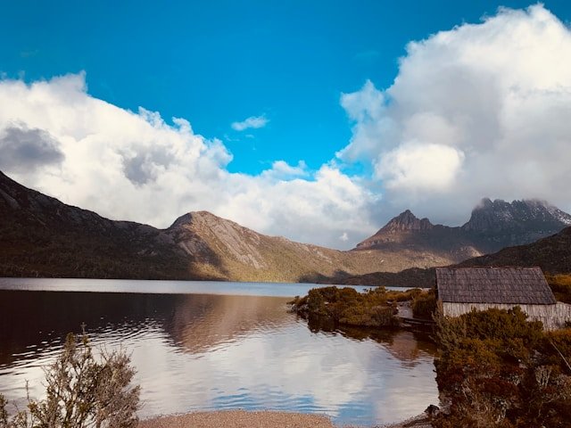
It also marks the southern end of the Overland Track, Tasmania’s best-known multi-day walking route.
A valid parks pass is required for the national park.
Things to Do at Lake St Clair
- Explore short forest walks.
- Walk beside the lake.
- Visit Cynthia Bay.
- Learn about the glacial landscape.
- Look for native wildlife.
- Use the area as a gateway to longer walks.
- Travel on the passenger ferry when operating and appropriate to your plans.
- Connect the Central Highlands with West Coast Tasmania.
Short Walks
Lake St Clair provides several shorter walking options that allow visitors to experience rainforest and lakeside environments without committing to a major alpine expedition.
Some routes can be combined into a larger circuit, while more experienced walkers can undertake substantially longer journeys.
Check current Parks information before setting out because weather and track conditions can change.
Winter Access
Tasmania Parks and Wildlife Service warns that both the Lyell Highway and the access road from Derwent Bridge to Lake St Clair can occasionally close because of snow in winter.
Check current road conditions before travelling specifically to the lake during cold weather.
How Does Cradle Mountain Connect with the Central Highlands?
Cradle Mountain and Lake St Clair share the same national park, but visitors should not treat them as neighbouring roadside attractions.
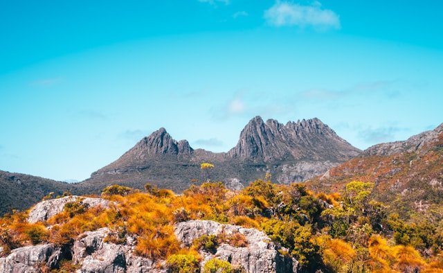
Cradle Mountain lies at the northern end of Cradle Mountain–Lake St Clair National Park, while Lake St Clair sits at the southern end.
There is no public road running through the national park directly between the two visitor centres.
This distinction is particularly important when planning driving times.
If Cradle Mountain is one of your main priorities, plan that destination separately through our Cradle Mountain Travel Guide. Travellers continuing farther north can then connect with North West Tasmania.
Hydro-Electric Heritage in the Central Highlands
Water has shaped both the natural and industrial history of Tasmania’s Central Highlands.
During the twentieth century, the state’s highland lakes and rivers became central to major hydro-electric development.
Dams, canals, pipelines, roads and settlements were constructed across parts of the interior, changing landscapes and supporting Tasmania’s electricity system.
For visitors interested in engineering and infrastructure, this history provides an additional reason to explore the Central Highlands rather than viewing it only as a fishing or wilderness destination.
Highlands Power Trail
The Highlands Power Trail links places associated with Tasmania’s hydro-electric story.
Bothwell can be used as a starting point for exploring parts of this self-guided touring route.
The trail can be particularly interesting when combined with Tarraleah and other areas where hydro infrastructure remains visible within the highland landscape.
Visitors interested in Tasmania’s larger hydro landscape may also find South West Tasmania relevant. Lake Pedder, Lake Gordon and Gordon Dam provide another major chapter in Tasmania’s hydro-electric geography, although they belong to a distinctly different wilderness region.
Trout Fishing in the Central Highlands
Trout fishing is one of the activities most closely associated with Tasmania’s Central Highlands.
Great Lake, Arthurs Lake, Little Pine Lagoon and numerous smaller waters attract anglers because of their varied conditions and established trout populations.
However, fishing rules are not uniform across the region.
Individual waters can have different seasons, permitted methods, size limits and bag limits.
A current Tasmanian inland fishing licence may also be required.
Always check Inland Fisheries Service Tasmania immediately before fishing rather than relying on an old article, previous trip or general rule.
Fishing Conditions
Highland fishing conditions can change rapidly.
Wind, cloud, cold temperatures and water levels can affect both fishing and boating.
Anyone travelling onto a lake by boat should check local weather and understand the risks of cold inland water and rapidly changing conditions.
Walking & Hiking in the Central Highlands
The Central Highlands offers one of the widest ranges of walking difficulty in Tasmania.
At one end is the easy Pine Lake boardwalk. At the other are multi-day journeys through Walls of Jerusalem and remote sections of the Tasmanian Wilderness World Heritage Area.
Walking in Central Highlands Tasmania ranges from short roadside stops to demanding alpine and wilderness routes requiring appropriate preparation.
Easy Walks
Pine Lake is one of the strongest options for an easy alpine experience.
Lake St Clair also provides several shorter developed walking routes.
Moderate and Longer Walks
Visitors with more time can explore longer routes around Lake St Clair and selected highland areas.
Difficulty should always be assessed according to current track information, fitness and weather rather than distance alone.
Remote Alpine Walking
Walls of Jerusalem and remote plateau routes require much more preparation.
Carry suitable navigation, waterproof clothing, warm layers, food and emergency equipment appropriate to the route.
Tasmanian alpine weather can include rain, wind, snow and strong sun during the same trip.
Wildlife in the Central Highlands
The highlands provide habitat for wildlife across forests, wetlands, moorlands and alpine environments.
Visitors may encounter wallabies, pademelons, wombats, echidnas and a range of birdlife.
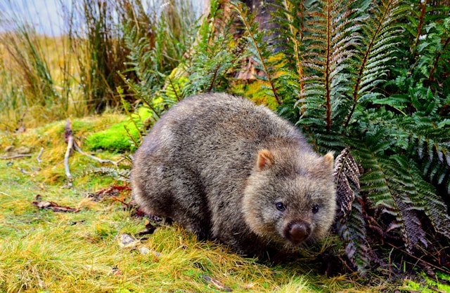
Lake St Clair also supports wildlife including wallabies, pademelons, wombats, echidnas, quolls and platypus, although sightings should never be treated as guaranteed.
Wildlife on Roads
Roadside wildlife is one of the most important practical considerations for highland travellers.
Animals are particularly active around dawn, dusk and at night.
Tasmania Parks and Wildlife Service advises visitors to avoid unnecessary night driving in reserves where possible.
If driving in low light is unavoidable, reduce speed and remain prepared for animals to enter the road unexpectedly.
Best Scenic Drives in the Central Highlands
Highland Lakes Road
The Highland Lakes Road is one of the defining drives through Tasmania’s interior.
It passes through high country beside Great Lake and continues towards the Great Western Tiers, providing an alternative inland connection between southern and northern Tasmania.
Pine Lake sits directly beside this corridor, making it easy to add a short alpine walk to the driving day.
Lyell Highway
The Lyell Highway provides another major Central Highlands route.
Travelling west from Hobart, the road moves through inland valleys, Tarraleah, Derwent Bridge and Lake St Clair before entering the wetter wilderness landscapes towards Queenstown.
This makes it one of the best routes for travellers who want to connect the Central Highlands with the West Coast.
Bothwell to Great Lake
The climb from Bothwell towards Great Lake provides one of the clearest transitions from Tasmania’s settled inland farmland into highland country.
Allow extra time for weather and scenic stops rather than treating the journey as a simple transfer.
Central Highlands Tasmania Road Trip
The Central Highlands works particularly well as a road-trip region because it can connect several otherwise separate parts of Tasmania.
Southern Highlands Route
A simple introduction is:
Hobart → Bothwell → Great Lake → Miena → Pine Lake → northern Tasmania.
This route works particularly well for travellers moving from South Tasmania towards North Tasmania without using the main Midlands route for the entire journey.
Western Highlands Route
Another strong journey is:
Hobart → Ouse → Tarraleah → Derwent Bridge → Lake St Clair → Queenstown → Strahan.
This route creates a natural transition from southern Tasmania into the Central Highlands and then West Coast Tasmania.
Highlands and Cradle Mountain Route
With more time, travellers can connect:
Lake St Clair → West Coast → Tullah → Cradle Mountain → North West Tasmania.
This creates a strong mountain-and-wilderness itinerary, but it requires several days and should not be compressed into one or two nights.
Continue with our Cradle Mountain guide and North West Tasmania Travel Guide before finalising that route.
Best Time to Visit Central Highlands Tasmania
The Central Highlands can be visited throughout the year, but altitude means the seasons are more pronounced than in many coastal parts of Tasmania.
Summer: December to February
Summer provides long daylight hours and is one of the most practical times for road trips, walking and camping.
Conditions can still become cold, wet or windy, particularly on the plateau and in alpine national parks.
Do not leave waterproof or warm clothing behind simply because the forecast is comfortable in Hobart or Launceston.
Autumn: March to May
Autumn can be excellent for road travel and photography.
Temperatures gradually fall and daylight becomes shorter, especially later in the season.
Frost becomes increasingly likely in highland areas.
Winter: June to August
Winter can transform the Central Highlands.
Snow, frost, frozen water and low cloud can create dramatic landscapes, but the same conditions can affect roads, tracks and accessibility.
Winter should be approached as a season requiring flexibility rather than as a guaranteed snow-sightseeing trip.
Spring: September to November
Spring brings longer days and increasing plant activity but can remain very changeable.
Late cold fronts and snow remain possible at higher elevations.
Visiting the Central Highlands in Winter
Winter is one of the most visually appealing but potentially challenging times to explore the highlands.
Weather in Central Highlands Tasmania can change quickly, particularly in elevated and exposed areas.
Winter can transform Central Highlands Tasmania, with frost, snow and icy conditions possible across higher parts of the region.
Snow
Snow occurs in the Central Highlands, but exact timing and depth vary enormously.
Never assume a particular road or lake will have snow simply because it is winter.
Equally, do not assume a road will remain straightforward because it is clear at lower elevation.
Ice
Ice can be a more subtle driving risk than snow.
Shaded roads, bridges and highland sections can remain icy even when the surrounding landscape looks clear.
Short Daylight Hours
Winter daylight is limited, so itineraries should contain fewer driving stops than an equivalent summer day.
Finishing highland driving before dark can also reduce wildlife risk.
Where to Stay in the Central Highlands
Accommodation is spread across a large region rather than concentrated in one major tourism town.
A longer stay in Central Highlands Tasmania gives travellers more flexibility to adjust plans around weather and explore beyond the major stops.
When planning accommodation in Central Highlands Tasmania, consider where you intend to finish each day’s drive rather than simply choosing the cheapest available base.
Bothwell
Bothwell works well for heritage-focused travellers and visitors approaching Great Lake from the south.
Miena & Great Lake
Miena and the Great Lake area suit travellers whose priorities are fishing, lake scenery and highland touring.
Tarraleah
Tarraleah can provide a useful overnight stop on a western highland journey and adds hydro-electric history to the itinerary.
Derwent Bridge & Lake St Clair
These areas are the strongest choices when Lake St Clair, national park walking or onward travel to the West Coast are priorities.
You can compare accommodation in Tasmania once your highland route is settled. In a region with long distances and limited services, location can be more important than choosing the cheapest room.
Camping & Campervan Travel
The Central Highlands can be rewarding for campers, but conditions require considerably more preparation than a sheltered coastal campground.
Cold temperatures, strong wind, rain and rapid weather changes can occur even outside winter.
Camp only in legal areas and check current land-manager requirements before travelling.
Several protected highland areas are Fuel Stove Only Areas, meaning fires are prohibited.
Travellers planning a larger campervan or camping trip can browse Camps Australia Wide travel guides when researching legal camping options across Tasmania. Always confirm each location’s current rules before staying.
Fuel, Food & Mobile Coverage
The Central Highlands is sparsely populated compared with Tasmania’s cities and coastal regions.
Fuel
Do not allow your fuel level to become unnecessarily low.
Fuel availability becomes less frequent away from the major highways and towns, and opening hours may be limited.
Food
Carry food and drinking water appropriate to the route rather than assuming every settlement will provide full supermarket or café services.
Mobile Reception
Mobile coverage can become unreliable in remote plateau and mountain areas.
Download offline maps and save accommodation, booking and emergency information before leaving populated areas.
International visitors who want mobile data can check eSIM options for Australia before travelling. An eSIM does not remove geographic network black spots, so offline navigation remains important.
Suggested Central Highlands Tasmania Itineraries
1-Day Central Highlands Itinerary
One day provides only a brief introduction.
- Morning: Travel from Hobart to Bothwell and explore the heritage town.
- Late morning: Continue towards Great Lake.
- Afternoon: Explore Miena and selected lakeside areas.
- Later afternoon: Continue north according to weather and daylight or return south.
Avoid trying to add Lake St Clair and Walls of Jerusalem to the same day. They belong to different travel corridors and require substantially more time.
2-Day Central Highlands Itinerary
Day 1 – Bothwell & Great Lake
- Explore Bothwell.
- Travel towards Great Lake.
- Spend time around Miena.
- Stay in the highlands.
Day 2 – Highland Lakes & Northern Connection
- Visit selected lake areas.
- Stop at Pine Lake.
- Continue towards Launceston or another part of North Tasmania.
This route works particularly well when connecting Hobart with Launceston.
3-Day Central Highlands Itinerary
- Day 1 – Bothwell: Explore the town and continue towards Great Lake.
- Day 2 – Great Lake & Central Plateau: Explore accessible highland lakes, Miena and Pine Lake.
- Day 3 – Tarraleah & Lake St Clair: Travel west through highland country towards Derwent Bridge and Lake St Clair.
This itinerary requires careful route planning because the Great Lake and Lake St Clair corridors are not simply adjacent roadside stops.
5-Day Central Highlands Itinerary
- Day 1 – Bothwell: Heritage, golf history and southern highland countryside.
- Day 2 – Great Lake: Miena, lake scenery and fishing or photography.
- Day 3 – Highland Lakes: Explore Pine Lake and selected plateau areas according to vehicle access and weather.
- Day 4 – Tarraleah & Derwent Bridge: Follow the western highland corridor and explore hydro heritage.
- Day 5 – Lake St Clair: Spend the day walking and exploring the southern end of Cradle Mountain–Lake St Clair National Park.
7-Day Central Highlands & Western Tasmania Itinerary
- Day 1 – Hobart to Bothwell: Explore heritage streets before staying in or near the district.
- Day 2 – Great Lake & Miena: Enter the high country and explore the lake environment.
- Day 3 – Central Plateau: Choose accessible lakes, Pine Lake or fishing according to conditions.
- Day 4 – Tarraleah & Derwent Bridge: Follow the western highland route.
- Day 5 – Lake St Clair: Spend a full day around the national park.
- Day 6 – Queenstown: Continue into West Coast Tasmania.
- Day 7 – Strahan or northern West Coast: Continue the western journey according to the rest of your Tasmania itinerary.
Connecting the Central Highlands with Other Tasmania Regions
One of the Central Highlands’ greatest advantages is its central position.
Central Highlands Tasmania can also be incorporated into a broader itinerary connecting Hobart, Lake St Clair, the West Coast and northern Tasmania.
Exploring Central Highlands Tasmania slowly gives you more opportunity to appreciate the region’s lakes, historic towns, hydro heritage and changing alpine landscapes.
Central Highlands & South Tasmania
Hobart and South Tasmania connect naturally with Bothwell, Tarraleah and the southern highlands.
If your trip begins with Hobart, Bruny Island or Port Arthur, the Central Highlands can provide a complete change of scenery for the next stage of the journey.
Central Highlands & North Tasmania
The Highland Lakes Road provides an inland connection towards North Tasmania and Launceston.
This can be particularly attractive for repeat visitors looking for an alternative to the direct Midlands Highway journey.
Central Highlands & West Coast Tasmania
Lake St Clair and the Lyell Highway create the strongest connection with the West Coast.
Continue through Franklin–Gordon Wild Rivers country towards Queenstown and Strahan rather than returning east.
Central Highlands & North West Tasmania
A longer mountain itinerary can connect Lake St Clair, the West Coast, Cradle Mountain and North West Tasmania.
Allow several days rather than treating these destinations as one continuous sightseeing day.
Central Highlands & South West Tasmania
The Central Highlands and South West Tasmania share themes of lakes, hydro-electric history and wilderness, but they should not be treated as the same region.
The South West includes places such as Lake Pedder and Gordon Dam and becomes substantially more remote beyond the end of the road network.
Central Highlands & East Coast Tasmania
The highlands also provide a dramatic contrast with East Coast Tasmania.
Travellers with enough time can combine highland lakes and alpine scenery with Freycinet National Park or the Bay of Fires, but the routes require careful geographic planning.
Use our Travel Tasmania regional guide before combining several of these areas into one trip.
Road & Walking Safety in the Central Highlands
Weather Changes Quickly
High elevation makes weather one of the most important considerations in the region.
Cold rain, wind, fog and snow are possible even when nearby lowland areas are experiencing mild conditions.
Check Road Conditions
Snow, ice, flooding, roadworks and fallen vegetation can affect highland roads.
Check current conditions before setting out during severe weather rather than relying solely on a route calculated earlier in the trip.
Do Not Underestimate Unsealed Roads
Some lake and wilderness access routes are unsealed.
Check rental-vehicle conditions before travelling and do not assume an ordinary car is appropriate for every road shown on a map.
Prepare Properly for Alpine Walks
Carry waterproof clothing, warm layers and appropriate footwear.
Longer routes may require navigation equipment, a Personal Locator Beacon, overnight equipment and the ability to remain self-sufficient.
Avoid Unnecessary Night Driving
Wildlife is particularly active in low-light conditions and highland roads can already be demanding because of fog, frost and bends.
Practical Central Highlands Travel Tips
1. Do Not Plan the Region by Distance Alone
Great Lake, Walls of Jerusalem and Lake St Clair can appear relatively close when viewed on a simplified map, but road access and terrain make them very different destinations.
2. Carry Warm Clothing All Year
Highland temperatures can be substantially cooler than Hobart or Launceston.
3. Keep the Fuel Tank Healthy
Do not wait until the fuel warning light appears before looking for the next service station.
4. Download Offline Maps
Do this before entering remote plateau or national park areas.
5. Check Fishing Regulations for Each Water
Different lakes and lagoons can have different rules.
6. Treat Walls of Jerusalem as a Wilderness Trip
It is not simply another roadside national park stop.
7. Stop at Pine Lake
If conditions are suitable, the short boardwalk offers one of the easiest introductions to Tasmania’s alpine vegetation.
8. Allow Flexibility in Winter
Snow and ice can change a driving itinerary quickly.
9. Avoid Over-Scheduling
The Central Highlands works best when the itinerary leaves time for weather, lake stops and slower driving.
10. Use the Highlands as a Connecting Region
Instead of visiting and returning by exactly the same road, consider using the region to connect South Tasmania with North Tasmania or the West Coast.
Frequently Asked Questions About Central Highlands Tasmania
Is Central Highlands Tasmania worth visiting?
Yes, particularly for travellers interested in lakes, alpine landscapes, fishing, heritage, scenic drives, hydro history and quieter parts of Tasmania.
How many days do you need in the Central Highlands?
Two days provides a brief introduction. Three to five days is better for combining Bothwell, Great Lake and Lake St Clair, while five to seven days or longer is useful for travellers including fishing, extensive walking or neighbouring regions.
What are the main places to visit?
Key destinations include Bothwell, Great Lake, Miena, the Central Plateau, Pine Lake, Walls of Jerusalem National Park, Tarraleah, Derwent Bridge and Lake St Clair.
Is Great Lake Australia’s largest natural freshwater lake?
It is better not to use that description. Great Lake is one of Tasmania’s major highland lakes and an important trout and hydro-electric water, but simplified size rankings can depend on how natural and modified lakes are classified.
Is Lake St Clair Australia’s deepest lake?
Yes. Tasmania Parks and Wildlife Service identifies Lake St Clair as Australia’s deepest freshwater lake, with a maximum depth of approximately 167 metres.
Is Cradle Mountain in the Central Highlands?
Cradle Mountain sits at the northern end of Cradle Mountain–Lake St Clair National Park. Island Files Tasmania treats it separately through our Cradle Mountain travel guide because road access and normal visitor routing are different from the southern Lake St Clair area.
Can you drive from Lake St Clair directly through the national park to Cradle Mountain?
No. There is no direct public road through Cradle Mountain–Lake St Clair National Park connecting the two visitor areas. Drivers need to travel around the national park using the surrounding road network.
Do you need a parks pass for Walls of Jerusalem?
Yes. Walls of Jerusalem is a Tasmanian national park and a valid parks pass is required.
Do you need a parks pass for Lake St Clair?
Yes. Lake St Clair is within Cradle Mountain–Lake St Clair National Park and a valid parks pass is required.
Is Pine Lake an easy walk?
The current official classification is Grade 1, approximately 800 metres return and around 30 minutes. However, it lies at high elevation and can experience severe alpine weather.
Can you visit Walls of Jerusalem in one day?
Selected experienced walkers may undertake day walking from the trailhead, but the best-known Central Walls experience is a multi-day wilderness journey. Parks currently describes the main circuit as approximately 23 kilometres, with many walkers taking around three days.
Do you need to register for the Walls of Jerusalem walk?
At the latest review, Tasmania Parks and Wildlife Service requires walkers undertaking the multi-day route to register. Check the current requirement before departure.
Can you camp in the Central Highlands?
Yes, in appropriate legal camping areas. Requirements vary significantly between national parks, conservation areas, council land and private campgrounds, so check the exact location before staying.
Can you have campfires in the Central Plateau?
The Central Plateau Conservation Area is currently designated Fuel Stove Only by Tasmania Parks and Wildlife Service, meaning fires are prohibited.
Do you need a 4WD in the Central Highlands?
No for the main highways, Great Lake, Bothwell, Miena, Pine Lake and other principal road-accessible destinations. However, Parks currently requires a four-wheel-drive vehicle for access into the Central Plateau interior beyond Lake Augusta.
Does it snow in the Central Highlands?
Yes. Snow occurs in the Central Highlands, particularly at higher elevations and during colder weather. Exact timing and depth vary, and roads can sometimes be affected.
Can you visit the Central Highlands in winter?
Yes. Winter can provide dramatic scenery, but snow, ice, limited daylight and road closures require greater flexibility and preparation.
What is the best time to visit?
There is no single best season. Summer provides long daylight for touring and walking, autumn can suit road trips, winter offers snow and frost when conditions align, and spring provides longer days with highly variable alpine weather.
Is Bothwell worth visiting?
Yes, especially for travellers interested in heritage, historic architecture and golf history. It also provides one of the easiest gateways towards Great Lake.
Is Miena worth staying overnight?
Yes if Great Lake, fishing or slower highland touring is a priority. Staying locally also provides more flexibility around changing weather.
Is Lake St Clair worth visiting?
Yes. Lake St Clair combines a major glacial lake, rainforest, wildlife, short walks and access to longer national park routes. It also fits naturally into a Central Highlands-to-West Coast road trip.
Can you combine the Central Highlands and West Coast?
Yes. This is one of the most natural regional combinations. The Lyell Highway connects Lake St Clair and Derwent Bridge with Queenstown and the wider West Coast.
Can you combine Central Highlands and Hobart?
Yes. Bothwell and the southern highlands can be reached from Hobart, while the Lyell Highway provides another route from Hobart towards Tarraleah and Lake St Clair.
Can you combine Central Highlands and Launceston?
Yes. The Highland Lakes Road can connect Great Lake and Pine Lake with northern Tasmania, making the Central Highlands a useful inland route between Hobart and Launceston.
Can you combine the Central Highlands and South West Tasmania?
Yes on a longer trip, but they are distinct regions. The Central Highlands focuses on Tasmania’s elevated interior and lake country, while South West Tasmania extends into much larger road-limited wilderness around Lake Pedder, Gordon Dam, Hartz Mountains and Southwest National Park.
Explore Tasmania’s Interior Slowly
The Central Highlands is one of the parts of Tasmania where travelling more slowly changes what you notice.
Bothwell introduces human history before the landscape begins to rise. Great Lake reveals the scale of Tasmania’s highland waters. Miena shows how communities have adapted to life at altitude. Pine Lake makes ancient alpine vegetation accessible within a short walk. Walls of Jerusalem takes the same landscape into an entirely different level of remoteness. Tarraleah adds the story of hydro-electric engineering, while Lake St Clair brings glacial geography and western wilderness together.
These places should not be compressed into one checklist merely because they all sit within central Tasmania.
A strong Central Highlands itinerary allows enough time for weather to change, roads to slow down and one lake or short walk to become more memorable than expected.
If you are travelling west, continue with our West Coast Tasmania Travel Guide. Heading north? Use our North Tasmania guide, Launceston guide, Cradle Mountain guide and North West Tasmania guide.
Travelling south? Continue through our South Tasmania Travel Guide and Hobart guide. Travellers interested in the more remote lake and hydro landscapes farther south can continue with our South West Tasmania Travel Guide.
For a complete island overview, return to Travel Tasmania: The Complete Guide to Every Region. For help deciding how to connect these destinations without spending your holiday constantly driving, read our complete Tasmania trip planning guide.
Planning note: Weather, national park access, walking registration requirements, fishing regulations, lake levels, road conditions, campground arrangements and visitor facilities can change. Before travelling, verify important details with Tasmania Parks and Wildlife Service, Inland Fisheries Service Tasmania and relevant transport or weather authorities. This is especially important for winter travel, remote plateau roads and multi-day alpine walking.
Affiliate disclosure: Some links on this page are affiliate links. If you make an eligible booking or purchase through one of these links, Island Files Tasmania may receive a commission at no additional cost to you. Affiliate links are included where they may be useful for planning a Tasmania trip.