
The Bay of Fires is one of the most distinctive stretches of coastline in Tasmania. White sand, clear blue water, granite boulders covered in brilliant orange lichen and long sections of relatively undeveloped shoreline combine to create a landscape that can look almost unreal on a bright day.
Yet the Bay of Fires is much more than a single beach or one famous viewpoint.
The name describes an extended coastal area in north-east Tasmania, with Binalong Bay at its southern end and larapuna / Eddystone Point marking the northern boundary. Between them are beaches, rocky coves, conservation land, camping areas, coastal heath, wildlife habitat and quieter sections of shoreline that reward travellers who allow more than a quick photo stop.

For many visitors, Binalong Bay and the road north towards The Gardens provide the easiest introduction. Travellers with more time can explore further, camp beside the coast or incorporate the Bay of Fires into a longer journey through East Coast Tasmania.
This complete Bay of Fires Tasmania travel guide explains where the Bay of Fires is, how to get there, what the name actually refers to, the best places to explore, beaches and camping areas, swimming and water safety, wildlife, photography, weather, suggested itineraries and practical information for planning your visit.
If the Bay of Fires forms part of a larger holiday, you can also begin with our Travel Tasmania guide to understand how the north-east fits into the rest of the island.
Bay of Fires Tasmania: Quick Guide
- Location: North-east Tasmania
- Southern gateway: Binalong Bay
- Nearest major service town: St Helens
- Known for: White beaches, clear water and orange-lichen-covered granite boulders
- Popular places: Binalong Bay, The Gardens, Swimcart Beach, Cosy Corner and other beaches and camping areas along the southern section
- Popular activities: Beach walking, photography, camping, swimming where conditions are suitable, kayaking, fishing, snorkelling, diving and wildlife watching
- Good base: Binalong Bay or St Helens
- Recommended time: At least half a day for a brief introduction; one or two days provides a much more relaxed experience
- National park pass: The northern section from the mouth of the Ansons River towards larapuna / Eddystone Point lies within Mount William National Park and requires a valid parks pass. Do not assume the same requirement applies to every part of the Bay of Fires Conservation Area.
Important: Conditions, campground arrangements, road access, fire restrictions and park requirements can change. Check current information with the relevant Tasmanian authorities before travelling, particularly if you plan to camp, enter national park areas or visit during periods of elevated fire or severe weather risk.
Jump to a Section
- Where Is the Bay of Fires?
- Why Is It Called the Bay of Fires?
- What Makes the Bay of Fires Special?
- Binalong Bay
- The Gardens
- Best Places to Explore
- Things to Do at the Bay of Fires
- Bay of Fires Beaches
- Camping at the Bay of Fires
- Swimming and Water Activities
- Walking and Exploring the Coast
- Wildlife and Nature
- Photography at the Bay of Fires
- Best Time to Visit
- How to Get to the Bay of Fires
- Where to Stay
- Bay of Fires Itineraries
- Adding the Bay of Fires to a Tasmania Road Trip
- Practical Visitor Tips
- Frequently Asked Questions
Where Is the Bay of Fires?
The Bay of Fires lies on Tasmania’s north-east coast, north of St Helens. Binalong Bay marks the southern end of the Bay of Fires, while larapuna / Eddystone Point, within Mount William National Park, marks its northern boundary.
This distinction is useful because visitors sometimes arrive at Binalong Bay expecting the words “Bay of Fires” to describe one individual beach. In reality, the name applies to a much longer coastal landscape containing numerous beaches, bays, headlands and protected areas.
Binalong Bay is therefore best understood as a gateway to the Bay of Fires rather than the Bay of Fires in its entirety.
For a first visit, the southern section is particularly convenient. From St Helens, travellers can reach Binalong Bay and continue north along the coastal road towards The Gardens. Along and around this stretch are several beaches, rocky areas and camping locations that display the combination of white sand, granite and orange lichen for which the region is known.
The northern Bay of Fires is more remote. The section extending from the mouth of the Ansons River towards larapuna / Eddystone Point lies within Mount William National Park, where national park requirements apply.
This geography is one reason it is worth deciding what kind of Bay of Fires experience you want before you arrive. A traveller with only a few hours will usually concentrate on Binalong Bay and The Gardens. Someone staying for several days can explore more beaches, camp, visit the northern sections or combine the coast with other north-east Tasmania destinations.
The Bay of Fires is also a natural northern extension of an East Coast Tasmania road trip. Travellers moving north through Freycinet, Bicheno, Scamander and St Helens can reach the region without having to make a major cross-island detour.
Is the Bay of Fires the Same as Binalong Bay?
No. Binalong Bay is a small coastal settlement and beach at the southern end of the Bay of Fires. It is one of the most accessible and photographed places in the region, but it represents only a small part of the wider coastline.
If you type “Bay of Fires” into a map or navigation app, the result may not necessarily represent the exact place you had in mind. For a first visit, navigating to Binalong Bay and then following the coastal route towards The Gardens is often easier than trying to find a single destination called Bay of Fires.
Why Is It Called the Bay of Fires?
The name has an interesting history, and it is also the source of one of the most common misconceptions about the area.
The Bay of Fires was named by British navigator Captain Tobias Furneaux in 1773 after he observed numerous fires along the coastline. Those fires were associated with Aboriginal people living in and using the area.
In other words, the name “Bay of Fires” was not created because of the orange colour on the granite rocks.
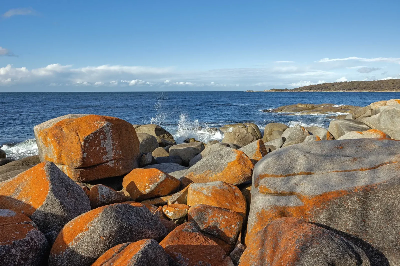
That misunderstanding is easy to make. The bright orange lichen covering many of the granite boulders can resemble fire, particularly when illuminated by low morning or evening sunlight. Today those rocks are among the most recognisable visual features of the Bay of Fires.
But the European name predates modern tourism imagery and refers to the fires Furneaux saw from offshore.
The landscape has a much deeper Aboriginal history than the European name suggests. Tasmania Parks and Wildlife Service identifies larapuna as an Aboriginal name associated with the area and records significant Aboriginal cultural heritage along this coastline, including midden sites that provide evidence of hunting, gathering and food preparation over long periods.
These places are culturally significant and should be treated with respect. Visitors should leave shell middens, artefacts and other cultural material exactly where they find them and avoid disturbing dunes or heritage sites.
What Makes the Bay of Fires Special?
The Bay of Fires is not defined by one enormous landmark. Its appeal comes from the relationship between several natural elements repeated along the coast.
Granite headlands extend into blue water. Pale beaches run between rocky points. Orange and red lichen spreads across exposed boulders. Behind the beaches, coastal vegetation creates a relatively low and natural horizon.
On a clear day, these colours create unusually strong contrasts: orange against blue, white against green, and granite against transparent water.
Yet the experience changes substantially with the weather.
Under cloud, the coastline can feel subdued and wild. Wind can turn otherwise calm-looking water into rough surf. Mist can soften the granite headlands. After a weather change, the same beach photographed the previous afternoon may look completely different.
This variation is part of the attraction.
The Bay of Fires also remains relatively lightly developed compared with many internationally known beach destinations. Outside the main settlements and visitor areas, there are stretches where the dominant features remain sand, rock, vegetation and sea rather than large-scale built infrastructure.
That does not mean every part is deserted. Binalong Bay, popular camping areas and accessible viewpoints can become busy during summer, school holidays and other peak periods. But travellers who allow time to explore rather than visiting one famous photo location can often experience a much broader side of the region.
The Famous Orange Rocks
The orange colour on many Bay of Fires rocks comes from lichen growing on the granite.
Lichen is not simply paint-like staining on the stone. It is a living partnership involving fungi and photosynthetic organisms, and coastal lichens can survive in exposed environments where salt, wind and changing moisture make conditions challenging.
For visitors, the result is one of Tasmania’s most recognisable natural colour palettes.
Please avoid damaging or deliberately removing lichen for photographs. The rocks are most valuable exactly as they are.
White Sand and Clear Water
The beaches provide the second half of the Bay of Fires’ visual identity. Pale sand and clear coastal water make sheltered sections particularly inviting in settled weather.
However, appearance should never be used as a substitute for assessing swimming conditions. Tasmania Parks and Wildlife Service specifically warns that Bay of Fires beaches can have steep drop-offs into deep water and may be affected by rips.
Conditions vary from beach to beach and from day to day. If you plan to swim, assess the conditions carefully, supervise children closely and avoid entering the water when you are uncertain about currents, waves or your ability.
Binalong Bay: The Southern Gateway to the Bay of Fires
For most first-time visitors, Binalong Bay is the logical place to begin.
The small seaside community sits at the southern end of the Bay of Fires and is easily reached from St Helens. Its broad beach, granite formations and access to the road leading north make it both a destination in its own right and a practical starting point for exploring the surrounding coastline.
If you have seen photographs of impossibly clear water framed by orange rocks and white sand, there is a reasonable chance that at least some were taken in or around Binalong Bay.
But arriving, photographing one cluster of rocks and immediately leaving misses much of what makes the area enjoyable.
Allow time to walk.
The beach changes character as you move along it. Different rocky points create different perspectives, and the colour of the water changes with sunlight, cloud cover and depth.
What to Do at Binalong Bay
- Walk along the beach rather than viewing it only from the road.
- Explore accessible granite areas without disturbing vegetation or cultural sites.
- Photograph the orange lichen and coastline in changing light.
- Enjoy a picnic where permitted and suitable.
- Watch for seabirds and marine wildlife.
- Swim only when conditions are appropriate for your experience and ability.
- Continue north towards The Gardens for a broader Bay of Fires experience.
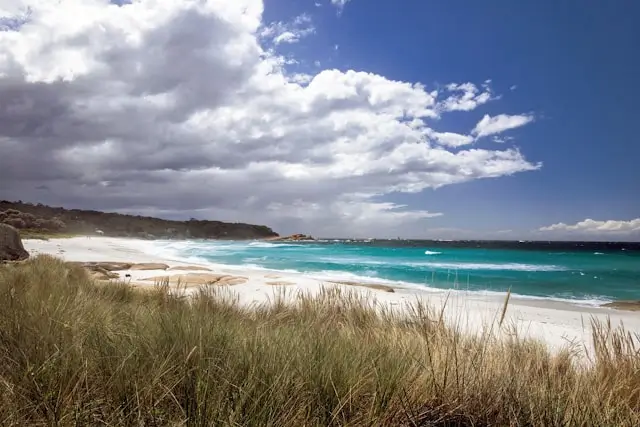
Binalong Bay can work as a short stop, but staying nearby changes the experience considerably. Early morning and evening allow you to see the coast outside the middle of a day trip, and changing light can make familiar viewpoints look completely different.
If you are comparing accommodation around Binalong Bay, St Helens or elsewhere on the East Coast, you can search accommodation options through Expedia. Compare location and cancellation conditions carefully before booking, particularly during Tasmania’s busier summer travel period.
The Gardens
Continue north from Binalong Bay and the coastal road eventually reaches The Gardens, another of the best-known locations in the southern Bay of Fires.
The drive itself is part of the experience. Rather than moving directly from one named attraction to another, there are opportunities to appreciate how the coastline shifts between beaches, vegetation, rocky coves and granite headlands.
The Gardens is particularly associated with the granite-and-lichen scenery that many visitors hope to photograph. The landscape here can feel more intimate than a broad open beach, with rocks breaking the shoreline into smaller visual compositions.
It is worth knowing that the road towards The Gardens does not provide a continuous vehicle route through the entire Bay of Fires. Tasmania Parks and Wildlife Service advises that the sealed road terminates at private land at The Gardens.
That means you should not plan your road trip on the assumption that you can simply follow the shoreline north by car from Binalong Bay all the way to larapuna / Eddystone Point.
Instead, think of the southern and northern sections as areas requiring different road approaches.
Why Visit The Gardens?
The Gardens works particularly well for travellers interested in photography, relaxed coastal exploration and seeing the classic orange-rock scenery beyond Binalong Bay.
There is no need to rush.
Look at the coastline from several angles, watch how the light changes across the rocks and give other visitors space. The natural setting is the attraction, so a slower visit often feels more rewarding than attempting to turn every stop into a checklist item.
Best Places to Explore Around the Bay of Fires
There is no single correct list of Bay of Fires stops. Some travellers come for beaches, others for camping, photography, fishing or quiet coastal scenery.
For a first visit, however, the following locations provide a useful framework.
1. Binalong Bay
Binalong Bay is the easiest introduction and the most practical choice if your time is limited. It combines a beautiful beach with accessible granite scenery and straightforward road access from St Helens.
If you have only half a day, begin here and continue towards The Gardens rather than trying to cover the entire geographical Bay of Fires.
2. The Gardens
The Gardens is one of the strongest locations for appreciating the granite formations and orange lichen at close range. It also gives visitors a sense of how the landscape changes as they move north from Binalong Bay.
3. Swimcart Beach
Swimcart Beach is a popular beach and camping location in the southern section of the Bay of Fires Conservation Area.
It appeals particularly to travellers who want to spend more time beside the coast rather than simply stopping for photographs. Tasmania Parks and Wildlife Service lists Swimcart among the designated campgrounds in this section of the conservation area.
Despite the name, do not assume swimming conditions are automatically safe. Assess the ocean on the day and remember that Bay of Fires beaches can have rips and steep drop-offs.
4. Cosy Corner
Cosy Corner is another well-known camping area along this coastline, with designated northern and southern camping sections listed by Tasmania Parks and Wildlife Service.
For campers, places like Cosy Corner can provide a very different Bay of Fires experience from staying in conventional accommodation. Instead of arriving during the middle of the day and leaving after a few hours, you experience the coast through evening, night and early morning.
5. Jeanneret Beach
Jeanneret Beach is another designated campground area in the southern Bay of Fires Conservation Area. Facilities are basic, which is part of the character of camping here but also means visitors should arrive prepared.
Current Parks and Wildlife Service information states that dogs are not permitted at the Jeanneret Beach campground, even though dogs on leads are permitted at several other Bay of Fires campgrounds. Always check current signage and rules rather than assuming the same conditions apply everywhere.
6. Sloop Reef and Seatons Cove
Sloop Reef and Seatons Cove are also among the designated southern camping locations identified by Tasmania Parks and Wildlife Service.
These smaller named areas help illustrate why the Bay of Fires is better approached as a coastline to explore than a single attraction. Travellers who slow down begin to discover that each beach and rocky section has a slightly different orientation, exposure and character.
7. Grants Lagoon
Grants Lagoon provides another camping option in the southern section and can suit travellers looking for a simple base close to the broader coastal environment.
As with all basic campgrounds, arrive self-sufficient. Do not assume access to shops, showers, drinking water, power or other facilities unless the current official campground information specifically confirms them.
8. Policemans Point
Policemans Point is located in the northern section of the Bay of Fires Conservation Area, south of Ansons Bay. It is reached differently from the Binalong Bay–The Gardens section and is useful for travellers exploring the quieter northern side of the region.
Parks and Wildlife Service notes that the outlet of Ansons Bay cannot be crossed from the campground, an important detail if you are planning routes on foot or assuming the coastline provides uninterrupted passage.
9. larapuna / Eddystone Point
At the northern end of the Bay of Fires, larapuna / Eddystone Point lies within Mount William National Park.
This is an important distinction for trip planning. The northern section from the mouth of the Ansons River towards larapuna / Eddystone Point is national park land and requires a valid Tasmania parks pass.
Visitors heading this far north should plan the journey separately rather than assuming it is a simple continuation of the Binalong Bay coastal road.
Things to Do at the Bay of Fires
The Bay of Fires is primarily a nature-based destination. There is no need to fill every hour with organised activities. In many cases, the most memorable experience is simply having enough time to explore a beach, walk around a headland, watch changing weather or sit beside the coast.
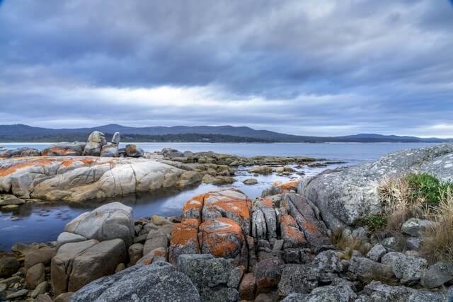
Still, there is considerably more to do than take photographs of orange rocks.
Walk the Beaches
Beach walking is one of the simplest ways to experience the Bay of Fires properly.
Walking reveals details that are easy to miss from a car: shells, birdlife, patterns in granite, small coves and changes in water colour. It also gives you a much better sense of scale.
Check tides, weather and access conditions before committing to longer coastal walks, and avoid assuming that every rocky point or watercourse can be safely crossed.
Photograph the Granite and Lichen
The Bay of Fires is naturally suited to landscape photography because its strongest colours contrast so clearly.
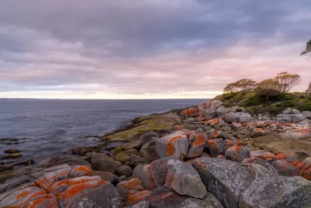
Early and late light can bring additional texture to the rocks, while overcast conditions reduce harsh contrast and produce a completely different mood.
You do not need to climb onto exposed or unstable rocks to get a strong photograph. Prioritise safe footing and avoid trampling fragile vegetation for a better angle.
Watch for Wildlife
The Bay of Fires supports marine, coastal and terrestrial wildlife.
Dolphins may be seen offshore, and the coast forms part of Tasmania’s East Coast Whale Trail. Humpback and southern right whales can pass the coastline during migration periods.
Birdlife includes shorebirds, oystercatchers, gulls and occasionally white-bellied sea eagles. In surrounding vegetation, wallabies and possums are relatively common, while animals such as spotted-tail quolls and Tasmanian devils are considerably more elusive.
Wildlife sightings are never guaranteed. Observe animals from a respectful distance and do not feed them.
Snorkelling and Diving
The Bay of Fires is also known for reefs, underwater formations and marine life, making snorkelling and diving possible in suitable locations and conditions.
Tasmanian water can remain cold even when the beach looks warm and inviting. Appropriate equipment, experience and an understanding of local conditions matter.
Never judge underwater safety solely by how calm the surface appears from shore.
Kayaking and Paddling
Protected-looking bays can be attractive for kayaking and paddling, but wind and sea conditions can change quickly along the Tasmanian coast.
Use equipment appropriate for the conditions, carry the necessary safety gear and do not paddle beyond your experience level. If you are unfamiliar with the area, a guided experience can provide local knowledge as well as equipment.
Fishing
Fishing is another established recreational activity around the Bay of Fires. Anyone planning to fish should check current Tasmanian fishing regulations, licences where applicable, seasonal rules, size and bag limits and any location-specific restrictions before starting.
Rock fishing deserves particular caution. Swell can reach exposed rocks unexpectedly, and wet granite can be slippery. Never choose a fishing position simply because it provides a good view of the water.
Camp Beside the Coast
Camping is one of the experiences that distinguishes the Bay of Fires from a conventional beach day trip.
Designated campgrounds allow travellers to stay close to the coastline with relatively basic facilities. This simplicity is part of the appeal, but it also requires preparation and responsible behaviour.
The detailed camping section later in this guide explains the current arrangement and the important rules to check before travelling.
Slow Down
This may sound less exciting than an organised activity, but it is one of the most useful recommendations for the Bay of Fires.
Do not turn the coastline into a race between map pins.
Choose a beach. Walk for a while. Sit somewhere safe. Watch the water. Explore another section later.
The Bay of Fires works particularly well as a contrast to a busier Tasmania itinerary filled with long drives and scheduled attractions.
If you are still building the wider journey around this visit, our complete East Coast Tasmania guide can help you connect the Bay of Fires with St Helens, Bicheno and the Freycinet region rather than treating each destination as an isolated trip.
Bay of Fires Beaches
One of the pleasures of visiting the Bay of Fires is discovering that there is no single “Bay of Fires beach.” The coastline is made up of numerous beaches and coves separated by granite headlands and rocky sections.
Binalong Bay receives much of the attention because it is accessible and visually impressive, but travellers who continue north encounter a much broader coastal landscape.
Which Bay of Fires Beach Should You Visit?
If this is your first visit and you have limited time, begin with Binalong Bay. It provides the easiest introduction and combines well with a drive to The Gardens.
If you are camping, Swimcart Beach, Cosy Corner, Jeanneret Beach and the other designated campground areas provide opportunities to spend longer near the coastline.
If you want a quieter or more extensive north-east journey, investigate the northern section separately and consider how it fits with Mount William National Park.
Are the Beaches Good for Families?
The beaches can be wonderful places for families to walk, picnic and explore, but parents should not interpret clear water as automatically safe water.
Parks and Wildlife Service warns that beaches in the area may have steep drop-offs and rips. Conditions can vary considerably, so children should be actively supervised around the ocean and swimming decisions should be based on the conditions you encounter on the day.
Families may also find Binalong Bay and accommodation around St Helens easier logistically than remote camping, particularly when travelling with very young children or needing regular access to shops and services.
Are Bay of Fires Beaches Crowded?
That depends strongly on when and where you visit.
Summer, public holidays and school-holiday periods naturally attract more visitors. Accessible locations such as Binalong Bay can feel much busier at these times.
Outside peak periods, the region can feel considerably quieter. Even during busy periods, spending longer in the area rather than concentrating on the most photographed viewpoint can provide a different experience.
Do not rely on social-media photographs showing an empty beach as proof that you will have the location to yourself. Visitor numbers vary by season, weather, time of day and location.
Camping at the Bay of Fires
Camping is one of the most popular ways to experience the Bay of Fires, especially for travellers who want to wake beside the coast and spend several days exploring without returning to a town every evening.
At the time of this guide’s latest review, Tasmania Parks and Wildlife Service states that designated Bay of Fires Conservation Area campgrounds are free and do not require bookings.
That information is useful, but it should not be treated as permanent.
Camping arrangements, restrictions and management policies can change. Always check current Parks and Wildlife Service information immediately before your trip.
Where Can You Camp?
Camping is permitted only in designated campgrounds.
In the southern section north of Binalong Bay towards The Gardens, Parks and Wildlife Service currently identifies campgrounds including:
- Grants Lagoon
- Jeanneret Beach
- Swimcart Beach
- Cosy Corner South
- Cosy Corner North
- Seatons Cove
- Sloop Reef
Policemans Point provides a designated campground in the northern section of the Bay of Fires Conservation Area.
Facilities Are Basic
Do not approach Bay of Fires camping as though you are arriving at a full-service holiday park.
Facilities vary between campgrounds. Some have toilet facilities and accommodate different combinations of tents, campervans and caravans, while individual campground suitability differs.
Check the current campground table provided by Parks and Wildlife Service for your intended site and vehicle type before travelling.
Bring sufficient food, drinking water and essential supplies rather than expecting to purchase everything at the campground. St Helens is the main service centre for stocking up before heading farther along the coast.
Campfires and Fire Restrictions
Fire rules deserve particular attention.
Restrictions can change according to season and fire conditions, and signage erected on site takes precedence. Total Fire Bans can also impose much stricter limitations.
Parks and Wildlife Service encourages Bay of Fires campers to have a fuel stove available for cooking because fire restrictions can change.
Never assume that because someone used a campfire at the same campground last year—or even recently—you are permitted to light one during your visit.
Check current restrictions before lighting any fire and follow all local signage.
Camping With Dogs
Current Parks and Wildlife Service information states that dogs on leads are permitted in Bay of Fires campgrounds except Jeanneret Beach. Local dog-zone rules may also apply.
Because rules can change and protected areas may have different requirements, check the current regulations for the exact location you intend to visit rather than applying one rule to the entire Bay of Fires coastline.
Responsible Camping
The simplicity of Bay of Fires camping depends on visitors treating the area carefully.
- Camp only in designated areas.
- Take rubbish with you where disposal facilities are unavailable.
- Do not dump chemical toilet waste into campground toilets.
- Use the appropriate dump facilities for campervan and caravan waste.
- Respect fire restrictions.
- Do not damage vegetation to enlarge a campsite.
- Do not feed wildlife.
- Keep noise reasonable, particularly at night.
- Leave cultural heritage and natural objects undisturbed.
If you are travelling Tasmania by campervan or camping more widely around the island, printed and offline travel resources can be useful when reception is unreliable. You can browse Camps Australia Wide travel guides when preparing a longer camping or road-trip itinerary.
Affiliate note: Some planning links in this guide are affiliate links. If you make an eligible booking or purchase through one of these links, Island Files Tasmania may receive a commission at no additional cost to you. We include them only where they may be useful for trip planning; you are always welcome to book directly or use another provider.
Swimming and Water Activities at the Bay of Fires
The clear water around the Bay of Fires is one of the first things many visitors notice. On a calm day, sheltered sections can look exceptionally inviting. However, the coastline should never be judged by appearance alone.
Tasmania Parks and Wildlife Service warns that beaches in the Bay of Fires area can have steep drop-offs into deep water and may be affected by rips. Many beaches are unpatrolled.
This means swimming decisions should be made according to the actual conditions on the day, your swimming ability and the experience of anyone travelling with you.
Can You Swim at the Bay of Fires?
Yes, people do swim at beaches around the Bay of Fires when conditions are suitable. But there is no guarantee that a particular beach will be safe for swimming simply because the sea appears calm.
Look carefully for waves, currents, deeper channels and changes in the shape of the beach before entering the water. If you are uncertain about conditions, staying out of the water is the safer option.
Families should supervise children closely around the shoreline. Even shallow-looking water can deepen quickly, and strong waves can arrive unexpectedly.
Water Temperature
Tasmanian coastal water can remain cool even when the weather is warm. Visitors arriving from warmer parts of Australia or overseas may find the water colder than expected.
If you intend to spend significant time swimming, snorkelling, diving or paddling, clothing and equipment suitable for cool water may improve both comfort and safety.
Snorkelling
Granite reefs and clear water can make sections of the Bay of Fires appealing for snorkelling in suitable conditions.
Choose sheltered areas with good visibility and avoid entering the water when swell, wind or currents make conditions unsuitable. Snorkel with another person rather than alone where possible, and remain conscious of cold water even on sunny days.
Diving
Diving around north-east Tasmania can reveal rocky reefs and marine life below the surface. Visitors planning independent dives should have suitable experience, check weather and sea conditions and follow current Tasmanian marine regulations.
Travellers unfamiliar with local conditions may prefer to use a qualified operator rather than treating a visually sheltered bay as evidence that diving conditions are straightforward.
Kayaking and Paddleboarding
Kayaking and paddleboarding can provide another way to experience the coastline, particularly in calm conditions.
Wind is one of the main considerations. A bay that feels protected from the beach can become difficult to paddle once you move farther from shore, and offshore winds can make returning significantly harder.
Wear appropriate personal flotation equipment, check the weather and avoid paddling beyond your ability or equipment.
Fishing
Fishing is part of the recreational culture of the wider north-east coast, but regulations vary according to species, season and fishing method.
Before fishing, check the current Tasmanian rules for licences, bag limits, size limits, seasonal closures and any local restrictions.
Rock fishing deserves particular caution. Do not stand on exposed granite where waves can reach you unexpectedly, and avoid wet, algae-covered or sloping rock surfaces when conditions are uncertain.
Walking and Exploring the Bay of Fires Coastline
The Bay of Fires does not require a major summit hike to be rewarding. Some of the most enjoyable exploration happens simply by walking along beaches, around accessible headlands and through sections of coastal vegetation.
That simplicity can be deceptive. Coastal walking still requires awareness of tides, weather, slippery rocks, changing water levels and where you intend to return to your vehicle.
Beach Walking
Long sandy sections around Binalong Bay and farther north are well suited to relaxed beach walking.
Rather than concentrating only on one photographed cluster of rocks, walking farther along the beach often reveals quieter sections of shoreline and a better sense of the scale of the region.
Keep track of how far you have travelled. Walking for an hour in one direction also means allowing enough time and energy to return.
Walking Around Granite Headlands
Granite boulders and headlands are a major part of the Bay of Fires landscape, but they should be approached carefully.
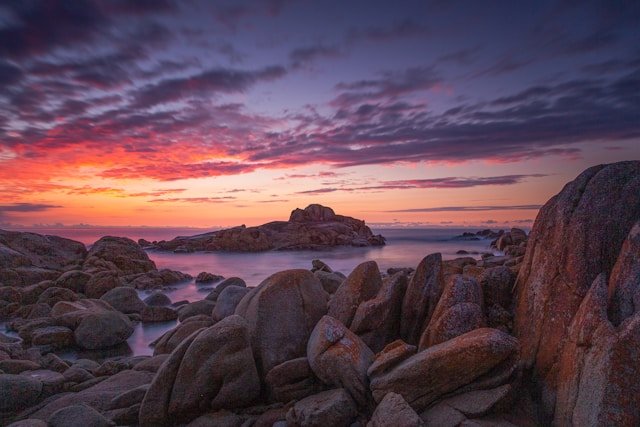
Dry rock can provide firm footing in some places, while wet granite, lichen and algae can become very slippery. Avoid scrambling into exposed areas simply to find a better photograph.
Longer Coastal Walking
Travellers interested in longer walks can explore more substantial sections of the north-east coast, including areas near Mount William National Park.
The terrain becomes more remote as you move away from the easiest southern access points. Longer walks should therefore be planned with current maps, weather, water, food and emergency considerations rather than approached as casual beach strolls.
For multi-day walking routes, always check the latest Parks and Wildlife Service information before departure because access, campsites and route conditions can change.
Wildlife and Nature at the Bay of Fires
The Bay of Fires supports a mixture of marine, coastal and terrestrial wildlife. While visitors often focus first on the colour of the rocks and water, spending longer in the area reveals a much richer natural environment.
Wildlife encounters remain unpredictable, and the best approach is to observe rather than attempt to influence animal behaviour.
Whales
The Bay of Fires forms part of Tasmania’s East Coast Whale Trail.
Humpback whales and southern right whales may be seen during migration periods as they move along the Tasmanian coastline.
Binalong Bay and The Gardens are among the places where interpretive information helps visitors understand whale migration and responsible viewing.
A whale sighting should always be treated as a fortunate encounter rather than something guaranteed by a particular month or viewpoint.
Dolphins and Seals
Dolphins and seals may also be seen offshore.
Binoculars can be useful for watching marine wildlife without trying to approach animals more closely from boats, rocks or beaches.
Birdlife
Shorebirds, seabirds and raptors use the Bay of Fires coastline and surrounding vegetation.
Visitors may see oystercatchers, gulls, terns and other coastal species, while white-bellied sea eagles may occasionally be observed around the wider region.
Nesting shorebirds can be particularly vulnerable to disturbance. Follow signs, keep away from marked nesting areas and do not allow pets to disturb birds.
Wallabies and Other Mammals
Wallabies, possums and other native mammals occur in the vegetation around the coastline.
Some animals become accustomed to people around campgrounds, which makes it especially important not to feed them.
Keep food secured, particularly at night, and avoid leaving scraps around campsites.
Wildlife on Roads
Native animals are frequently active around dawn, dusk and at night.
If possible, plan your day so that you are not completing long rural sections after dark. When low-light driving cannot be avoided, reduce speed and remain alert.
Photography at the Bay of Fires
The Bay of Fires is one of Tasmania’s strongest photography destinations because the landscape contains naturally contrasting colours and textures.
Orange lichen, pale granite, white sand, blue-green water and low coastal vegetation can all appear within the same frame.
Best Light for Photography
Early morning and later afternoon often provide softer light than the middle of the day.
Low-angle light can reveal more texture in the granite and deepen the apparent colour of the lichen.
That does not mean cloudy weather is poor for photography. Overcast conditions reduce harsh contrast and can create a quieter, more dramatic interpretation of the coast.
Photographing the Orange Lichen
The orange lichen is often most effective when used as part of a larger composition rather than treated as an isolated object.
Try incorporating the sea, sand or another granite formation into the frame to show how the colour relates to the wider coastline.
Binalong Bay for Photography
Binalong Bay is convenient because the combination of beach and granite is easy to access.
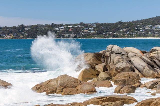
It can also become busy during popular travel periods, so patience and respectful use of shared viewpoints is important.
The Gardens for Photography
The Gardens provides another strong location because rock formations break the shoreline into smaller coves and compositions.
Instead of trying to reproduce one famous image, explore safely and look for your own perspective.
Photography Safety
Do not stand on exposed wet rocks, cross barriers, climb unstable formations or position yourself within wave reach for a photograph.
The coastline will still be there without taking unnecessary risks.
Best Time to Visit the Bay of Fires
The Bay of Fires can be visited throughout the year.
Rather than asking which season is objectively best, it is more useful to consider what you want to do.
Summer: December to February
Summer brings long daylight hours and generally warmer conditions, making it popular for beach trips, swimming, camping, kayaking and long days of coastal exploration.
It is also one of the busiest times.
Binalong Bay and popular campgrounds can attract considerably more visitors during summer holidays, school holidays and long weekends.
Do not assume summer guarantees hot, calm weather. Wind, rain and cool changes remain possible.
Autumn: March to May
Autumn can be a particularly comfortable period for road trips and beach walking.
The peak of summer demand generally begins to ease, while conditions can still be mild enough for long periods outdoors.
Days become shorter as autumn progresses, so allow more daylight margin if you are travelling between the Bay of Fires and another region.
Winter: June to August
Winter reveals a quieter and often moodier Bay of Fires.
Swimming becomes less appealing for many visitors, but beach walking, wildlife watching, photography and quiet coastal exploration remain worthwhile.
Shorter daylight hours and colder conditions mean a winter itinerary should generally involve fewer late-day driving commitments.
Spring: September to November
Spring brings increasing daylight, flowering coastal vegetation and active wildlife.
Conditions remain variable, and windy or cool weather can occur even after a warm morning.
Spring can suit travellers who want a quieter alternative to summer while still benefiting from increasingly long days.
Best Time for Photography
Photography depends more on light and weather than the calendar.
Clear days produce strong blue-and-orange colour contrast, while cloudy and stormy weather can give the coastline a more dramatic atmosphere.
Best Time for Camping
Warmer months are naturally popular for camping, but they also bring higher demand and potentially greater fire risk.
Check current weather and fire restrictions before departure regardless of season.
How to Get to the Bay of Fires
The most practical road gateway for many visitors is St Helens.
From St Helens, Binalong Bay is only a relatively short drive, making it easy to combine the Bay of Fires with accommodation, fuel, food and other services in town.
St Helens to Binalong Bay
St Helens provides the simplest starting point for the southern Bay of Fires.
Travellers can drive to Binalong Bay and then continue along the coast towards The Gardens and designated camping areas.
Because the road towards The Gardens eventually terminates, do not assume the coast can be followed continuously by car all the way north to larapuna / Eddystone Point.
Freycinet to the Bay of Fires
The Bay of Fires fits naturally after Freycinet National Park on a northbound East Coast road trip.
A practical route follows Freycinet → Bicheno → Scamander → St Helens → Binalong Bay.
This is one of the reasons Freycinet and the Bay of Fires are often combined: they sit within the same broader East Coast Tasmania journey rather than requiring separate cross-island trips.
Launceston to the Bay of Fires
Travellers coming from Launceston can approach the north-east through inland routes towards St Helens.
If your trip continues south afterwards, this can create an efficient Launceston → Bay of Fires → Bicheno → Freycinet → Hobart itinerary.
For broader northern planning, see our North Tasmania Travel Guide.
Hobart to the Bay of Fires
The Bay of Fires can be reached from Hobart, but it is better treated as part of a multi-day East Coast journey than a rushed return day trip.
A more relaxed route is Hobart → Orford / Swansea → Freycinet → Bicheno → St Helens → Bay of Fires.
This allows the East Coast itself to become part of the holiday rather than simply a long road transfer.
Do You Need a Car?
A car gives most visitors the greatest flexibility because beaches, camping areas and viewpoints are spread along the coastline.
If you are flying into Tasmania and building a self-drive itinerary, you can compare car rental options in Tasmania once you know whether Hobart or Launceston is the better arrival point.
Check current rental conditions, particularly around unsealed roads, insurance and one-way hire fees.
Where to Stay Near the Bay of Fires
The best place to stay depends on whether you want direct beach access, full town services or a camping experience.
Binalong Bay
Binalong Bay is the strongest choice for travellers who want to wake close to the coast.
Staying locally provides easier access to the beach early in the morning and later in the day, when the light and atmosphere can be very different from the middle of a busy day trip.
The trade-off is that Binalong Bay is much smaller than St Helens and offers fewer services.
St Helens
St Helens is often the most practical base.
It offers a wider choice of accommodation, shops, fuel, food and other services while remaining close enough for easy Bay of Fires day trips.
Staying in St Helens can suit families, travellers who prefer conventional accommodation and anyone continuing inland towards Launceston after exploring the coast.
Camping
Camping provides the most direct way to stay within the coastal environment.
Facilities are basic, so it suits travellers who are comfortable being self-sufficient and following current campground and fire restrictions.
Once your dates are reasonably certain, you can compare accommodation near the Bay of Fires and St Helens. Consider distance from the coastline, parking, cancellation terms and the following day’s route rather than comparing price alone.
Should You Stay One or Two Nights?
One night works well when the Bay of Fires is one stop on a broader East Coast road trip.
Two nights is better for travellers who want to explore beyond Binalong Bay, spend time on the beach, photograph different light conditions or camp.
Three nights or more can suit slow travellers, families, campers and visitors using St Helens as a base for the wider north-east coast.
Suggested Bay of Fires Itineraries
The Bay of Fires can be explored in a few hours, but the experience becomes much more rewarding once the itinerary allows time to stop, walk and return to places under different conditions.
Half-Day Bay of Fires Itinerary
If you only have half a day, concentrate on the southern section.
- Start in St Helens: Make sure you have fuel, water and anything else you need before heading to the coast.
- Binalong Bay: Walk the beach and spend time around accessible granite formations.
- Drive towards The Gardens: Stop at one or two additional coastal areas rather than trying to photograph everything.
- The Gardens: Explore the rocky coastline safely before returning towards Binalong Bay or St Helens.
This is enough for a visual introduction but not enough to understand the entire geographical Bay of Fires.
One-Day Bay of Fires Itinerary
A full day provides much more flexibility.
- Morning – Binalong Bay: Walk along the beach and explore the coastline before the day becomes busier.
- Late morning – Coastal drive: Continue north and stop around selected beaches or granite areas.
- Lunch: Carry a picnic where appropriate or return towards services if preferred.
- Afternoon – The Gardens: Spend time exploring the rocky shoreline rather than treating it as a quick photo stop.
- Late afternoon: Return to another beach or Binalong Bay to experience changing light.
If swimming or water activities are part of the day, leave enough time to assess conditions rather than squeezing them between multiple driving stops.
Two-Day Bay of Fires Itinerary
Two days is an excellent amount of time for many visitors.
Day 1 – Southern Bay of Fires
- Binalong Bay
- Beach walking
- Coastal stops towards The Gardens
- The Gardens
- Sunset or late-afternoon photography if conditions suit
Day 2 – Slower Exploration
- Visit a quieter beach or camping area
- Spend time around Swimcart Beach, Cosy Corner or another designated area
- Walk a longer section of coastline
- Allow time for swimming, snorkelling or paddling only if conditions are suitable
- Return to St Helens or continue your East Coast journey
Three-Day Bay of Fires Itinerary
Three days allows the coast to become the destination rather than a stop between Freycinet and Launceston.
Day 1: Explore Binalong Bay and The Gardens.
Day 2: Spend a slower day around beaches, camping areas and coastal walks.
Day 3: Explore farther into the north-east or use the day for the national park section near larapuna / Eddystone Point if that is part of your route.
Travellers entering Mount William National Park should have a valid parks pass and check current access information before departure.
Adding the Bay of Fires to a Tasmania Road Trip
The Bay of Fires works particularly well within a larger East Coast journey because the route can continue naturally rather than requiring substantial backtracking.
Hobart to Bay of Fires Road Trip
A practical multi-day route can follow:
Hobart → Orford / Triabunna → Swansea → Freycinet → Bicheno → St Helens → Bay of Fires.
This route should generally be spread across several days rather than treated as a direct drive.
If you are beginning in the south, our South Tasmania Travel Guide and Hobart guide can help plan the earlier part of the journey.
Bay of Fires to Launceston
After exploring the Bay of Fires, many travellers continue inland towards Launceston.
This creates a natural end to a south-to-north East Coast road trip and avoids returning all the way down the coast.
Continue with our Launceston Travel Guide or North Tasmania Travel Guide.
Bay of Fires and Freycinet
Freycinet National Park and the Bay of Fires are among the two strongest natural anchors of an East Coast itinerary, but they offer very different experiences.
Freycinet combines mountains, constructed walking tracks, enclosed bays and more concentrated visitor infrastructure.
The Bay of Fires is more linear and open, with beaches, granite headlands, camping and coastal exploration spread across a much longer area.
Rather than asking which is better, consider them complementary.
Bay of Fires in a 7-Day Tasmania Trip
A first-time seven-day route might look like:
Hobart → Freycinet → Bicheno → Bay of Fires → Launceston.
This keeps the trip geographically coherent and avoids trying to add the West Coast, Cradle Mountain and North West Tasmania into the same week.
Bay of Fires in a 10-Day Tasmania Trip
With ten days, the Bay of Fires can be combined with a broader sequence such as:
Hobart → South Tasmania → Freycinet → Bicheno → Bay of Fires → Launceston → Cradle Mountain.
This still requires careful pacing, but it gives each major area more breathing room than a one-week circuit.
For the broader process of designing the route, use our complete Tasmania trip planning guide.
Planning Flights and Arrival Points
Both Hobart and Launceston can work for a Bay of Fires road trip, depending on the direction you intend to travel.
If you have not yet booked flights, you can compare flights to Tasmania and look at both Hobart and Launceston before choosing the route.
Compare the full itinerary rather than airfare alone. A slightly cheaper flight can become less useful if it creates extra accommodation nights, fuel or one-way car hire costs.
Mobile Coverage and Offline Navigation
Mobile coverage is generally better around St Helens and populated areas than in more remote sections of the coast.
Download offline maps before exploring farther from town and save accommodation addresses, booking details and important information directly to your phone.
International travellers who want mobile data can check eSIM options for Australia before arriving. An eSIM does not eliminate physical network black spots, so offline navigation remains useful.
Practical Visitor Tips for the Bay of Fires
1. Do Not Treat Binalong Bay as the Entire Bay of Fires
Binalong Bay is the southern gateway and an excellent first stop, but the Bay of Fires extends much farther north.
2. Allow More Time Than the Map Suggests
Short driving distances can turn into much longer sightseeing days once you begin stopping at beaches and granite headlands.
3. Bring Food and Water Before Leaving St Helens
Do not assume that every beach or campground will have shops, drinking water or food available.
4. Check Swimming Conditions
Bay of Fires beaches can have rips and steep drop-offs. Clear water does not automatically mean safe water.
5. Check Campground Rules Before Arriving
Camping is restricted to designated areas and individual campground facilities and rules vary.
6. Carry a Fuel Stove When Camping
Fire restrictions can change. Having a fuel stove gives you a cooking option when campfires are prohibited.
7. Respect Cultural Heritage
Do not disturb Aboriginal cultural sites, shell middens or artefacts. Leave cultural material exactly where it is found.
8. Do Not Feed Wildlife
Feeding wildlife changes natural behaviour and can create problems around campgrounds and roads.
9. Avoid Unnecessary Night Driving
Wallabies and other native animals can move onto roads around dusk and at night.
10. Leave the Coast as You Found It
Take rubbish with you, stay on established access routes, do not damage lichen or vegetation and avoid moving rocks for photographs.
11. Carry Layers
Weather can change quickly even during summer. A waterproof outer layer and an additional warm layer are useful throughout much of the year.
12. Leave Room for Weather
One cloudy or windy morning does not necessarily ruin a Bay of Fires visit.
Conditions can change rapidly, and different weather can create a very different but equally interesting coastline.
Frequently Asked Questions About the Bay of Fires
Where is the Bay of Fires in Tasmania?
The Bay of Fires lies on Tasmania’s north-east coast. Binalong Bay marks the southern end, while larapuna / Eddystone Point marks the northern boundary.
Is Binalong Bay the Bay of Fires?
Binalong Bay is part of the Bay of Fires and forms its southern gateway, but the Bay of Fires extends much farther north along the coastline.
Why is it called the Bay of Fires?
The name was given by British navigator Captain Tobias Furneaux in 1773 after he observed fires along the coast associated with Aboriginal people living in and using the area. The name does not originate from the orange lichen on the granite rocks.
What makes the rocks orange?
The bright orange colour comes from lichen growing on the granite. The lichen is part of the living coastal environment and should not be damaged or removed.
How many days do you need at the Bay of Fires?
Half a day is enough for a brief introduction to Binalong Bay and The Gardens. One full day is more comfortable, while two or three days suits travellers interested in beaches, camping, photography and slower coastal exploration.
Can you visit the Bay of Fires in one day?
Yes. A one-day visit can comfortably focus on Binalong Bay, several southern coastal stops and The Gardens.
Is the Bay of Fires worth visiting?
For travellers interested in beaches, coastal scenery, photography, camping and wildlife, the Bay of Fires is one of the most distinctive parts of Tasmania’s East Coast. Its value is strongest when visitors allow time to explore beyond one photo stop.
What is the best place to see the Bay of Fires?
Binalong Bay is the easiest place for a first visit. The Gardens is another strong southern stop for granite and orange-lichen scenery. Travellers with more time can explore designated beaches and camping areas farther along the coast.
Can you swim at the Bay of Fires?
Yes, when conditions are suitable, but many beaches are unpatrolled and can have rips and steep drop-offs. Assess conditions carefully before entering the water.
Is the water cold?
Tasmanian coastal water can remain cool even during warmer weather. Visitors planning longer periods in the water may benefit from equipment suitable for cooler conditions.
Can you camp at the Bay of Fires?
Yes. Camping is available at designated campgrounds within the Bay of Fires Conservation Area. Current arrangements should always be checked before travelling because rules, facilities and fire restrictions can change.
Is camping at the Bay of Fires free?
At the time of the latest review of this guide, Tasmania Parks and Wildlife Service lists designated Bay of Fires Conservation Area campgrounds as free and not requiring bookings. Check current official information before relying on this arrangement.
Do you need a parks pass for the Bay of Fires?
Not for every part of the Bay of Fires Conservation Area. The northern section from the mouth of the Ansons River towards larapuna / Eddystone Point lies within Mount William National Park, where a valid Tasmania parks pass is required.
Can dogs visit the Bay of Fires?
Dog rules vary by location. Current Parks information states that dogs on leads are permitted in several Bay of Fires campgrounds but not at Jeanneret Beach campground. Check current rules for the exact location you intend to visit.
Can you have a campfire at the Bay of Fires?
Fire rules depend on the campground, season and current restrictions. Total Fire Bans and local restrictions can prohibit fires. Always check current official information and on-site signage and carry a fuel stove as an alternative.
Do you need a 4WD for the Bay of Fires?
No 4WD is required for the main route to Binalong Bay and the commonly visited southern Bay of Fires areas. Some roads in the wider region may be unsealed, so check current road conditions and rental vehicle restrictions before travelling.
Is the road from Binalong Bay to The Gardens sealed?
The main coastal road towards The Gardens is accessible by conventional vehicles under normal conditions, and Tasmania Parks and Wildlife Service notes that the sealed road terminates at private land at The Gardens. Check current road information if conditions are poor.
Can you drive all the way from Binalong Bay to Eddystone Point along the coast?
No. The coastal road from Binalong Bay towards The Gardens does not continue as one uninterrupted vehicle route through the entire Bay of Fires. The northern section requires a different road approach.
How far is the Bay of Fires from St Helens?
Binalong Bay is only a short drive from St Helens, which is why St Helens works so well as the principal service base for Bay of Fires visitors.
Can you visit the Bay of Fires from Launceston?
Yes. The Bay of Fires can be reached from Launceston and works particularly well as the first major destination on a north-to-south East Coast journey.
Can you visit the Bay of Fires from Hobart?
Yes, but it is better incorporated into a multi-day East Coast trip than treated as a rushed return day trip from Hobart.
Should you stay in St Helens or Binalong Bay?
St Helens provides more accommodation, shops and services. Binalong Bay offers more immediate access to the coast. The better choice depends on whether convenience or a quieter beach setting matters more to you.
Can you combine the Bay of Fires and Freycinet?
Yes. Freycinet, Bicheno, St Helens and the Bay of Fires form one of the most natural road-trip sequences on Tasmania’s East Coast.
Is the Bay of Fires good for families?
Yes. Beaches, short walks and wildlife can make the region suitable for families, but children require close supervision around the ocean, granite rocks and unpatrolled beaches.
Is the Bay of Fires good in winter?
Yes. Winter is quieter and can be excellent for photography, walking and coastal scenery. Swimming is less attractive for many visitors, and shorter daylight requires more careful road-trip planning.
When is the best time to visit the Bay of Fires?
There is no single best season. Summer suits beaches and camping, autumn can provide comfortable road-trip conditions, winter is quieter, and spring offers increasing daylight and active wildlife.
Can you see whales at the Bay of Fires?
Whales may be seen during migration periods, and the region forms part of Tasmania’s East Coast Whale Trail. Sightings are never guaranteed.
Is there mobile reception at the Bay of Fires?
Coverage is generally stronger around St Helens and populated areas but can become less reliable in remote coastal sections. Download offline maps and important information before travelling farther from town.
Explore the Bay of Fires Slowly
The Bay of Fires is easy to recognise and easy to misunderstand.
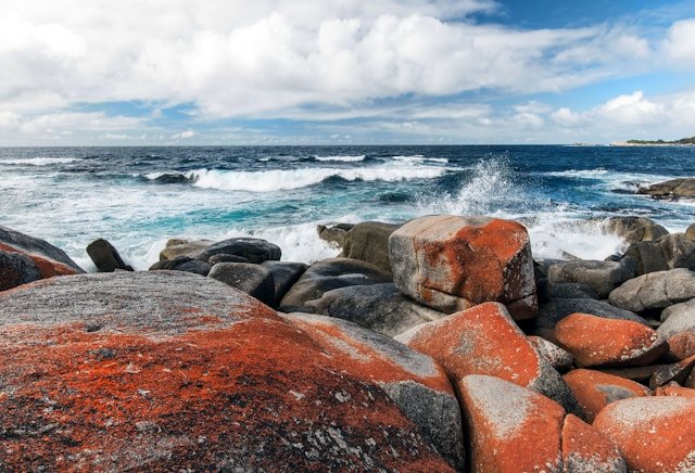
The orange rocks are memorable, but they are only one part of the landscape. Binalong Bay is beautiful, but it is only the southern gateway. The Gardens is one of the best-known stopping points, but the coastline continues well beyond it. Camping can put you closer to the landscape, while St Helens can make the entire visit easier to organise.
The region becomes more rewarding when you stop trying to reduce it to one perfect photograph.
Walk farther along the beach. Look at the granite from another angle. Spend time watching the sea. Visit another section of coastline. Allow weather to change the appearance of the place rather than assuming cloudy conditions have spoiled the day.
If the Bay of Fires is part of a larger road trip, continue with our East Coast Tasmania Travel Guide. Southbound travellers can continue towards Freycinet National Park, while visitors heading inland can use our Launceston guide and North Tasmania guide.
For island-wide planning, return to our Travel Tasmania guide. If you are still deciding how many days to spend in each region, use our complete Tasmania trip planning guide.
Planning note: Road conditions, campground arrangements, national park requirements, fire restrictions, swimming conditions, wildlife activity and visitor facilities can change. Check current information from Tasmania Parks and Wildlife Service and other relevant authorities before travelling, particularly if you intend to camp, enter Mount William National Park, undertake longer coastal walks or visit during severe weather or elevated fire-risk periods.