
Southwest Tasmania is where roads begin to disappear and some of Australia’s largest protected wilderness landscapes take over. Mountains, buttongrass plains, rainforest, immense lakes, wild rivers and remote coastline extend across a region that remains remarkably difficult to cross by ordinary road.
For travellers, that remoteness is fundamental to understanding the South West. This is not a region where you simply drive from one attraction to another through the middle of the wilderness. Instead, roads lead towards selected gateways: Lake Pedder and Gordon Dam from the north-east, Cockle Creek from the far south, Hartz Mountains from the Huon Valley side, and other locations around the enormous Tasmanian Wilderness World Heritage Area.
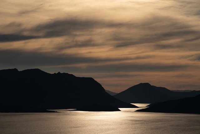
Beyond those roads lies a much larger landscape reached through walking tracks, waterways and, in places such as Melaleuca, aircraft or private boat.
This complete Southwest Tasmania travel guide explains how to explore the accessible edges of the region without giving the impression that the wilderness itself is easily accessible. It covers Southwest National Park, Gordon Dam, Lake Pedder, Lake Gordon, Strathgordon, Cockle Creek, South Cape Bay, Hartz Mountains National Park, Hastings Caves and Thermal Springs, Tahune Adventures, scenic drives, camping, walking, weather and suggested itineraries.
If you are planning a broader journey, begin with our complete Travel Tasmania guide. Southwest Tasmania also connects naturally with our South Tasmania Travel Guide, while travellers beginning in the capital can use our Hobart Tasmania Travel Guide before heading into the region.
Southwest Tasmania Quick Guide
- Region: Southern and south-western Tasmania
- Main wilderness area: Southwest National Park
- World Heritage: Large parts lie within the Tasmanian Wilderness World Heritage Area
- Major road-accessible highlights: Lake Pedder, Gordon Dam, Strathgordon and Cockle Creek
- Other southern gateways: Hartz Mountains, Hastings Caves and the Huon/Far South
- Best for: Wilderness, scenic driving, photography, walking, camping, lakes and remote landscapes
- Main northern approach: Gordon River Road via Maydena
- Main far-southern approach: Cockle Creek via the Huon Valley and Far South
- National park pass: Required for entry to Tasmania’s national parks
- Important: Large areas cannot be reached by ordinary public roads
- Recommended time: At least 3–5 days if combining several different gateways
- Melaleuca
- South Coast Track
- Port Davey Track
- Photography
- What to Pack
- Family Travel
- Accessibility
- Responsible Travel
- Book & Organise Your Trip
Jump to Southwest Tasmania
- About Southwest Tasmania
- Why Visit Southwest Tasmania?
- Getting to Southwest Tasmania
- Understanding the Region
- Southwest National Park
- Gordon River Road
- Gordon Dam
- Lake Gordon
- Lake Pedder
- Strathgordon
- Scotts Peak Road
- Walks & Hiking
- Cockle Creek
- South Cape Bay
- Hartz Mountains National Park
- Hastings Caves & Thermal Springs
- Tahune Adventures
- Wildlife & Nature
- Camping
- Weather & Best Time to Visit
- Suggested Itineraries
- Southwest Tasmania Road Trip
- Frequently Asked Questions
- Plan Your Trip
About Southwest Tasmania
Southwest Tasmania occupies an immense part of the island’s south-western quarter, yet relatively little of it can be explored from a conventional road network.
This is one of the most important facts to understand before planning a trip.
On an ordinary road map, Southwest Tasmania may appear to be another region that can be crossed from one side to the other. In reality, large sections contain no public through-road at all.
The landscape is dominated by protected wilderness, including Southwest National Park and other areas within the Tasmanian Wilderness World Heritage Area.
Mountain ranges rise beyond broad buttongrass plains. Rivers drain through largely undeveloped valleys. Temperate rainforest grows along wetter slopes and waterways. Lakes created or substantially altered through hydro-electric development occupy enormous areas around the region’s more accessible north-eastern edge.
Farther south, the land eventually meets some of Tasmania’s wildest coastline.
The result is a destination where the scale of what you cannot easily reach is as important as the places you can.
Is It Southwest or South West Tasmania?
Both forms are commonly encountered. Tasmania Parks and Wildlife Service uses Southwest National Park as the official park name, while travellers may search for both “Southwest Tasmania” and “South West Tasmania”.
Throughout this guide, Southwest Tasmania is generally used as the regional term while recognising South West as a common alternative spelling.
Why Visit Southwest Tasmania?
Southwest Tasmania is best suited to travellers who value landscape and wilderness more than a dense concentration of conventional attractions.
There are no large cities in the wilderness, few major roads and long stretches where the scenery itself is the reason for travelling.
1. Experience Tasmania at Its Wildest
Few regions demonstrate Tasmania’s wilderness character as strongly as the South West.
Even road-accessible locations can feel remote. Drive west from Maydena and settlements quickly disappear as the road enters forest, moorland and mountain country.
2. See the Scale of Lake Pedder and Lake Gordon
Lake Pedder and Lake Gordon dominate much of the accessible northern South West.
Their enormous scale becomes clearer from roadside viewpoints and high points than it does on a map. Mountains rise directly beyond water and forest, creating some of Tasmania’s most dramatic inland scenery.
3. Visit Gordon Dam
Gordon Dam combines engineering, hydro-electric history and wilderness scenery in one remarkable location.
The journey to the dam is itself a major part of the experience, following Gordon River Road deep into the South West before reaching the enormous concrete structure above the Gordon River.
4. Reach the End of Australia’s Southernmost Road
Cockle Creek provides a completely different entry into the South West.
Located beyond the Huon Valley and Far South, it marks the end of Australia’s southernmost public road and provides access to Southwest National Park and the South Cape Bay walk.
5. Explore Landscapes That Change with the Weather
Cloud, rain, wind and changing light are not merely inconveniences in Southwest Tasmania. They are part of the character of the landscape.
A mountain visible in clear morning light can disappear behind cloud an hour later. Calm lake surfaces can change rapidly when strong winds arrive.
That unpredictability is one reason flexible itineraries work particularly well here.
Getting to Southwest Tasmania
There is no single road that allows visitors to drive through the whole of Southwest Tasmania.
Instead, most road trips use separate approaches into different parts of the region.
Hobart to Lake Pedder and Gordon Dam
For Lake Pedder, Strathgordon and Gordon Dam, travellers generally leave Hobart towards the Derwent Valley and continue through or beyond Maydena on Gordon River Road.
The road eventually reaches Strathgordon and Gordon Dam, with access points and side roads leading towards other parts of Southwest National Park.
Tasmania Parks and Wildlife Service advises that fuel is not available past Maydena. Fill the tank before continuing west rather than expecting another service station near Lake Pedder or Strathgordon.
Hobart to Cockle Creek
Cockle Creek is approached from an entirely different direction.
From Hobart, travel south through the Huon region towards Geeveston, Southport and the Far South before continuing through Lune River and Ida Bay to Cockle Creek.
Tasmania Parks and Wildlife Service advises that the final road section is gravel but can generally be negotiated by two-wheel-drive vehicles with appropriate care.
There is no fuel beyond Southport, so fill up before continuing towards Cockle Creek.
Do You Need a Rental Car?
A vehicle provides the greatest flexibility for most visitors exploring the road-accessible parts of Southwest Tasmania.
You can compare Tasmania rental car options before your trip. If you plan to use unsealed roads, check the rental agreement carefully because vehicle companies may apply restrictions even where a road is ordinarily suitable for conventional vehicles.
Understanding Southwest Tasmania Before You Build an Itinerary
The easiest way to understand Southwest Tasmania is to divide a road trip into separate gateways rather than thinking of the region as one continuous driving loop.
Northern Wilderness Gateway
The Gordon River Road corridor provides access towards:
- Maydena
- Southwest National Park
- Lake Pedder
- Strathgordon
- Lake Gordon
- Gordon Dam
- Scotts Peak Road
- selected walking and camping areas
Far Southern Gateway
The Huon and Far South route provides access towards:
- Geeveston
- Hastings Caves and Thermal Springs
- Southport
- Recherche Bay
- Cockle Creek
- Southwest National Park
- South Cape Bay
- the eastern end of the South Coast Track
Huon Valley Mountain Gateway
Hartz Mountains National Park provides another way to experience southern Tasmania’s alpine environment without entering the vast roadless interior of Southwest National Park.
Tahune Adventures and other Huon Valley experiences can also be incorporated into this side of a broader South West journey.
Remote Wilderness
Beyond these road-accessible gateways lies the much larger wilderness.
Places such as Melaleuca and many remote mountain, river and coastal areas cannot be reached through an ordinary sightseeing drive.
This is why a realistic Southwest Tasmania travel guide should distinguish clearly between places accessible to ordinary visitors and routes requiring substantial wilderness experience.
Southwest National Park Tasmania
Southwest National Park Tasmania is the defining protected landscape of the region.
It is vast, mountainous and largely undeveloped. Rocky coastline, windswept beaches, mountain ranges, deep waterways, rainforest and extensive buttongrass plains occur across an area where much of the landscape remains beyond ordinary road access.
The park forms part of the Tasmanian Wilderness World Heritage Area, giving the landscape international conservation significance as well as extraordinary scenic value.
Can You Drive Through Southwest National Park?
No—not in the conventional sense.
Roads penetrate particular parts of the park and provide access to lakes, campgrounds, walking tracks and other destinations, but there is no public road crossing the wilderness from east to west or north to south.
For most visitors, exploring Southwest National Park means driving to one of its accessible edges and experiencing the wilderness from there.
Do You Need a Parks Pass?
Yes. A valid Tasmania parks pass is required when entering Tasmania’s national parks, including Southwest National Park.
If your trip includes several national parks, compare the current pass options before purchasing individual entries.
What Makes Southwest National Park Special?
The park’s defining feature is not one lookout or one walking track. It is scale.
Large parts remain without roads or permanent settlements. Experienced wilderness walkers can travel through mountain ranges and remote valleys for days, while ordinary road-trip visitors can stand at Lake Pedder or Cockle Creek and look into landscapes extending far beyond the road network.
That contrast between accessibility and remoteness makes Southwest National Park fundamentally different from many heavily developed tourism destinations.
Gordon River Road: One of Tasmania’s Great Wilderness Drives
Gordon River Road is one of the most accessible ways to experience the northern edge of Southwest Tasmania.
West of Maydena, the road becomes a narrow route through forests, mountain country and buttongrass landscapes before eventually reaching Strathgordon and Gordon Dam.
Tasmania Parks and Wildlife Service describes Gordon River Road and Scotts Peak Road as access routes into the immense landscapes around Lake Pedder and Lake Gordon.
The roads were constructed in association with hydro-electric development during the twentieth century. Their existence now provides road travellers with unusual access deep into landscapes that otherwise remain largely roadless.
Do Not Rush Gordon River Road
The drive should not be treated simply as transportation between Hobart and Gordon Dam.
Weather, forest, mountain views, lakes and short roadside stops make the journey itself one of the major things to do in Southwest Tasmania.
Leave enough daylight to stop safely rather than calculating the day around driving time alone.
Fuel Before Maydena
This deserves repeating: do not drive west assuming there will be another fuel station near Strathgordon.
Parks and Wildlife Service currently advises that fuel is not available beyond Maydena.
Top up before entering the remote section of the journey.
Gordon Dam
Gordon Dam is one of the most dramatic engineering landmarks in Tasmania and a major reason travellers follow Gordon River Road into the South West.
The concrete arch dam rises approximately 140 metres above its foundation and holds back Lake Gordon as part of Tasmania’s hydro-electric system.
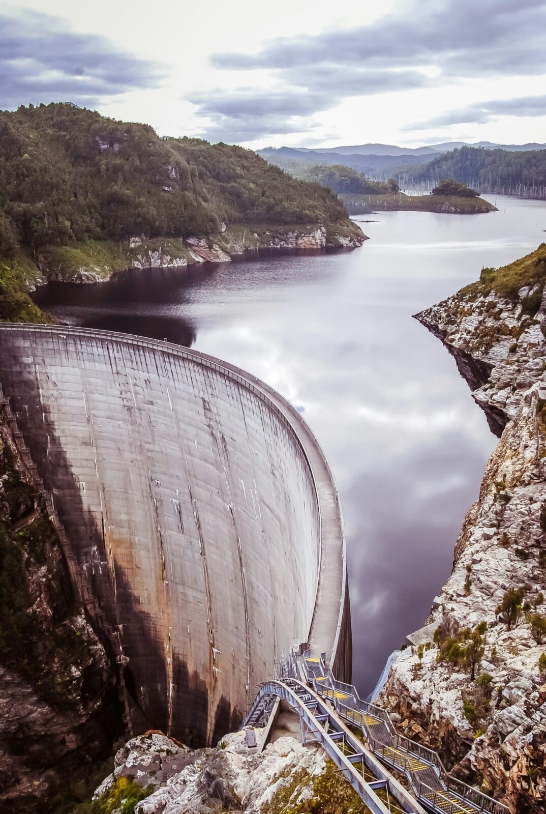
Its curved wall and immense scale contrast sharply with the surrounding mountain wilderness.
For visitors, the experience is not simply about seeing a dam. The road ends deep within remote country, and the combination of engineering and landscape gives Gordon Dam a setting unlike most infrastructure attractions in Australia.
What Can You Do at Gordon Dam?
- View the dam and surrounding landscape
- Photograph the curved concrete wall
- Look across Lake Gordon
- Experience the end of the Gordon River Road
- Learn more about Tasmania’s hydro-electric history
- Combine the visit with Lake Pedder and Strathgordon
Is Gordon Dam Worth the Drive?
For travellers interested in engineering, photography or remote landscapes, yes.
However, Gordon Dam makes most sense when the entire Gordon River Road journey is treated as the experience rather than driving several hours solely to photograph the dam and immediately return.
Lake Gordon
Lake Gordon forms one of the enormous inland water landscapes of Southwest Tasmania.
The reservoir is closely associated with Gordon Dam and Tasmania’s hydro-electric network, but from a visitor perspective its scale and setting are equally significant.
Mountains, forest and deeply indented shorelines surround an immense body of water extending through remote country.
Fishing and Boating on Lake Gordon
Lake Gordon is used for trout fishing and boating, but it should not be treated like a sheltered recreational lake.
Tasmania Parks and Wildlife Service warns that submerged timber creates a significant boating hazard on Lake Gordon and that sudden, extreme weather changes can occur on both Lake Gordon and Lake Pedder.
Anyone heading onto the water should check weather and current boating requirements and carry equipment appropriate to a remote environment.
Lake Pedder
Lake Pedder is one of the defining landscapes of Southwest Tasmania.
Today’s vast lake occupies an enormous basin surrounded by mountain ranges and wilderness.
Its modern form is inseparable from Tasmania’s hydro-electric history. The original natural Lake Pedder and its famous quartzite beach became submerged following hydro-electric development and the creation of the enlarged impoundment in the early 1970s.
The flooding became one of the most consequential environmental controversies in Australian conservation history.
Visitors today therefore encounter a landscape with several layers of meaning: extraordinary scenery, hydro-electric infrastructure, wilderness conservation and the history of the original lake.
Why Visit Lake Pedder?
- Mountain and lake photography
- Scenic driving
- Fishing
- Boating for appropriately prepared visitors
- Camping
- Access to wilderness walking areas
- Understanding Tasmania’s hydro-electric and conservation history
Lake Pedder Weather
Conditions around Lake Pedder can change rapidly.
Mountain weather can bring strong wind, heavy rain and cold conditions at any time of year. Parks and Wildlife Service specifically warns visitors using the lakes that extreme and sudden weather changes are possible.
Carry layers and weather protection even when leaving Hobart under clear skies.
Strathgordon
Strathgordon is a small settlement near Lake Pedder and Gordon Dam and provides one of the few established visitor bases deep within this part of Southwest Tasmania.
Its location makes it particularly useful for travellers who want to explore Gordon Dam and Lake Pedder without attempting the entire journey from Hobart and back in one rushed day.
Should You Stay Overnight at Strathgordon?
For photographers, walkers and travellers who enjoy remote landscapes, an overnight stay can significantly improve the experience.
It gives you more flexibility around weather and allows the Gordon River Road to become part of the trip rather than a long commute.
You can compare accommodation options for Southwest and southern Tasmania. Always check the exact property location before booking because distances in this region are substantial and accommodation choices are limited.
Scotts Peak Road and the Lake Pedder Wilderness
Scotts Peak Road branches away from the Gordon River Road corridor and leads farther into the Lake Pedder landscape.
The route provides access towards campgrounds, walking areas and wilderness trailheads, including areas associated with some of Tasmania’s most challenging mountain routes.
This is where ordinary scenic driving and serious wilderness travel begin to separate.
A visitor can drive the road for scenery and selected short stops without being equipped for a multi-day mountain expedition. But anyone continuing onto remote walking tracks needs substantially more preparation.
Creepy Crawly Nature Trail
The Creepy Crawly Nature Trail provides a much more accessible taste of cool temperate rainforest than the major wilderness routes.
The fully boarded track winds among moss-covered trees and large fallen logs, creating a short forest experience that contrasts strongly with the open buttongrass and lake landscapes nearby.
Despite being short, the track includes stairs and sections where visitors need to bend beneath branches, so it is not suitable for every mobility level.
Huon Campground
Huon Campground provides camping access around the Scotts Peak Road side of Southwest National Park and also connects with the beginning of the Port Davey Track.
Visitors looking for a short experience can follow the early section of the track through moorland and rainforest before returning rather than continuing into remote wilderness.
Walking and Hiking in Southwest Tasmania
Southwest Tasmania contains everything from short rainforest walks to some of Australia’s most demanding wilderness routes.
That range makes careful terminology important.
A roadside nature trail and the Western Arthur Range are both “walks”, but they require completely different levels of preparation, equipment and experience.
Shorter Walks
Visitors interested in experiencing the environment without undertaking a major expedition can choose shorter options around the road-accessible parts of the park.
These can include rainforest walks, campground tracks, short viewpoints and coastal walks around Cockle Creek.
South Cape Bay
South Cape Bay provides one of the most accessible opportunities to reach genuinely wild southern coastline on foot and is covered in greater detail later in this guide.
Mount Anne and Eliza Plateau
The Mount Anne area introduces visitors to substantially more challenging mountain terrain.
The climb towards Eliza Plateau becomes steep and involves large boulders, with views opening towards the Eastern and Western Arthur ranges and Lake Judd.
The full Mount Anne Circuit is a remote multi-day wilderness undertaking intended for highly experienced walkers. Current overnight walker registration requirements apply to specified routes, including the Mount Anne Circuit.
Western Arthur Range
The Western Arthur Range should not be presented as an ordinary tourist hike.
It is remote, physically demanding mountain terrain where weather can deteriorate quickly and where walkers need appropriate navigation, equipment and wilderness experience.
Overnight walker registration currently applies to the Western Arthur Range.
South Coast Track
The South Coast Track is one of Tasmania’s major multi-day wilderness walks, linking the Cockle Creek area with Melaleuca through remote southern country.
This is an expedition rather than a casual extension of a Cockle Creek visit.
Walkers need appropriate wilderness experience, equipment, navigation and transport planning. Melaleuca has no ordinary road connection, so logistics differ fundamentally from a conventional point-to-point road trip.
Cockle Creek: The End of the Road
Cockle Creek is one of the most memorable places to visit in Southwest Tasmania because the journey quite literally reaches the end of the public road.
Located beside Recherche Bay at Tasmania’s far southern edge, Cockle Creek combines sheltered coastal scenery with immediate access to Southwest National Park.
Mountain peaks rise beyond calm bays, tannin-coloured streams reach the sea and walking tracks continue into country where the road cannot.
How Do You Get to Cockle Creek?
From Hobart, travel south through the Huon region and Geeveston before continuing towards Southport, Lune River and Ida Bay.
The final section beyond Ida Bay is gravel. Parks and Wildlife Service currently advises that it can be negotiated by two-wheel-drive vehicles, campervans and vehicles towing caravans when driven with care.
Do not confuse “2WD accessible” with an ordinary suburban road. Drive to conditions and allow additional time.
No Fuel Beyond Southport
Fuel planning is essential.
Parks and Wildlife Service advises that there is no fuel beyond Southport on the Cockle Creek approach.
Fill up before continuing into the Far South rather than assuming fuel will be available at the end of the road.
The Whale Sculpture
A bronze southern right whale sculpture near Cockle Creek has become a recognisable landmark and provides a reminder of the area’s whaling history.
The surrounding region also has much deeper Aboriginal history and connections, as well as associations with European exploration, timber, coal and later settlement.
Camping at Cockle Creek
Camping is available in designated areas around Cockle Creek and Recherche Bay, but facilities and individual campground arrangements vary.
Some sites can be affected by seasonal closures, maintenance or other management requirements, so check current Parks and Wildlife Service alerts before driving south specifically to camp.
For travellers building a wider campervan itinerary, you can browse Camps Australia Wide travel guides as an additional planning resource. Always verify individual overnight locations against current official campground information before relying on them.
South Cape Bay
South Cape Bay provides one of the most rewarding ways for capable day walkers to move beyond the road and experience Tasmania’s wild southern coastline.
The walk begins from Cockle Creek and forms the easternmost section of the much longer South Coast Track.
The landscape changes as the route moves through forest and open country towards the coast before eventually reaching South Cape Bay.
At the coast, the character of the South West becomes unmistakable: exposed ocean, strong wind, wild surf and a shoreline facing the Southern Ocean.
Is South Cape Bay an Easy Walk?
It should not be treated as a short roadside stroll.
Although considerably more accessible than the region’s major multi-day wilderness routes, it is still a substantial return day walk in an environment where weather and track conditions matter.
Check the current Parks and Wildlife Service track information, carry appropriate clothing, food and water, and leave enough daylight for the return journey.
Check Current Southwest Tasmania Alerts Before Travelling
Remote Tasmania is particularly sensitive to road works, weather, track conditions and infrastructure closures.
At the time of this guide’s latest fact-check in August 2026, Tasmania Parks and Wildlife Service lists several active alerts affecting parts of Southwest National Park and Cockle Creek.
These include the closure of the Edgar Dam boat ramp and campground while works continue into late 2026. Access to the Strathgordon and Scotts Peak boat ramps remains available, while Huon and Teds Beach campgrounds remain open according to the current alert.
At Cockle Creek, the Catamaran campground and boat ramp are currently listed as closed until 29 September 2026 for infrastructure improvements, while other camping and toilet facilities remain available in the area.
These details are included to help current visitors, but they should not be treated as permanent features of this guide. Check official alerts immediately before departure because closures can be extended, shortened or replaced by new conditions.
Planning Southwest Tasmania as Part of a Larger Tasmania Trip
Southwest Tasmania rewards travellers who allocate time rather than trying to squeeze it between distant destinations.
If this is your first Tasmania holiday, read our complete guide to planning a trip to Tasmania before deciding how many days to allocate to the South West.
Unlike a conventional coastal route, the South West contains several dead-end wilderness roads. This means the distance shown between two places on a map can be misleading because you may need to return towards Hobart or the Huon Valley before entering another part of the region.
For a broader understanding of neighbouring destinations, use our South Tasmania Travel Guide. Travellers continuing around the island can return to our Travel Tasmania regional guide to compare the South West with Tasmania’s other major regions.
Flights, Accommodation and Transport for Southwest Tasmania
Hobart is the most practical starting point for many Southwest Tasmania itineraries. Organising the major transport components first makes it easier to decide whether to use Hobart as a base or stay overnight deeper in the region.
You can compare flights for your Tasmania trip before building the road-trip section of your itinerary.
For overnight stops, compare accommodation across Hobart, southern Tasmania and the Southwest region. Always inspect the property’s actual map location because accommodation described broadly as “Southwest Tasmania” may be several hours from the attraction you intend to visit.
If you require a vehicle, compare Tasmania rental car options and check restrictions relating to unsealed roads before booking.
Hartz Mountains National Park
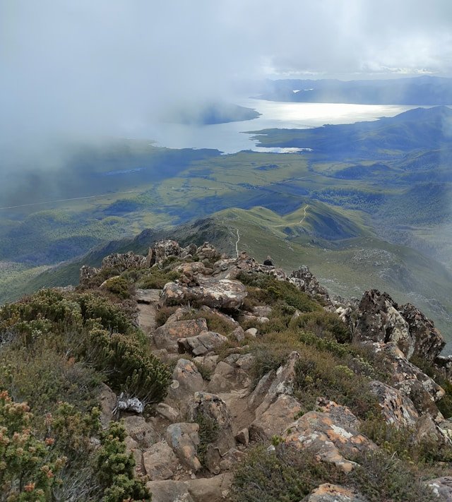
Hartz Mountains National Park provides one of the most accessible ways to experience alpine scenery on the south-western side of Tasmania without entering the roadless interior of Southwest National Park.
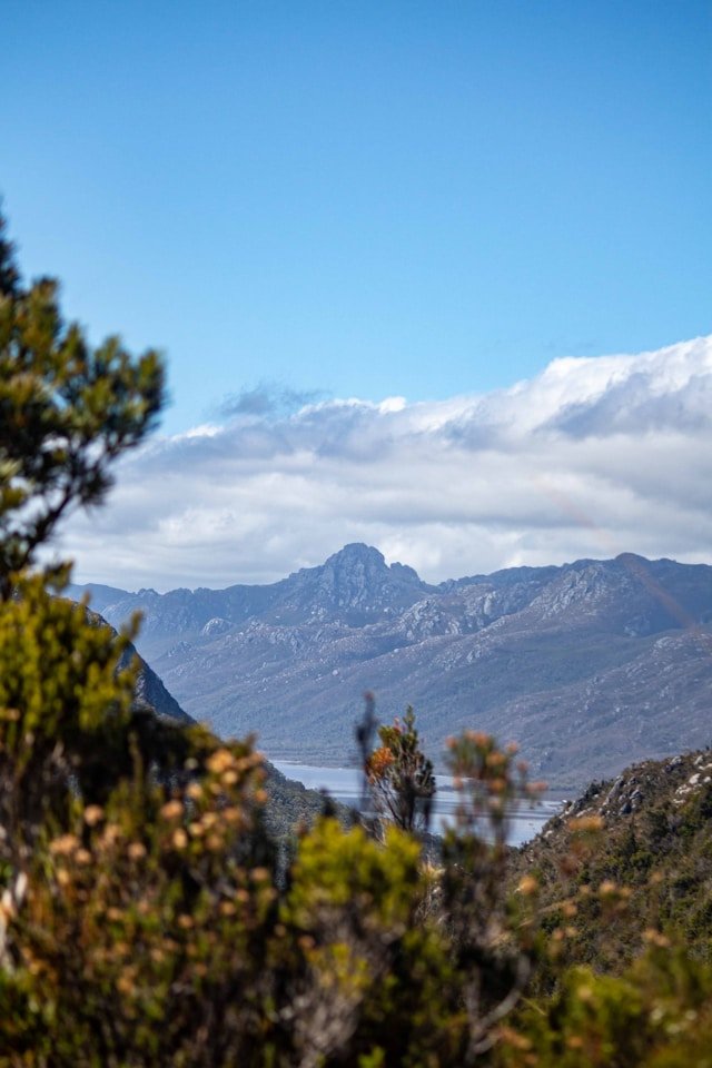
The park lies south-west of Hobart via Geeveston and forms part of the Tasmanian Wilderness World Heritage Area. Its landscape includes alpine vegetation, glacially formed lakes, dolerite peaks and broad views towards the surrounding wilderness.
It is also an exposed mountain environment where conditions can change rapidly.
Getting to Hartz Mountains
Tasmania Parks and Wildlife Service currently places Hartz Mountains National Park about 1.5 hours south-west of Hobart via Geeveston. The final road section is unsealed, and winter snow can affect access. 0
Visitors should check road conditions immediately before travelling. Parks advises against continuing in snow unless the vehicle is appropriately equipped, including chains where required. 1
Shorter Hartz Mountains Walks
Not every Hartz Mountains visit needs to involve climbing Hartz Peak. Shorter walks provide an introduction to the alpine landscape and can be a better choice when weather, daylight or fitness do not suit a longer route.
Lake Osborne is one option. Parks advises visitors to register their walk at the booth beside the main car park, even for shorter walks, and to sign out when they return. 2
Hartz Peak
Hartz Peak is one of the park’s major walks and reaches approximately 1,254 metres above sea level. In clear conditions, the summit can provide expansive views across South West wilderness, including distant mountain ranges. 3
The summit is exposed to severe weather, so a good forecast and appropriate all-weather clothing are essential. Even when the Huon Valley below appears calm, conditions higher in the park can be considerably colder and windier. 4
There are currently no camping facilities within Hartz Mountains National Park itself. 5
Hastings Caves and Thermal Springs
Hastings Caves and Thermal Springs provides a very different experience from Southwest Tasmania’s lakes and exposed mountain landscapes.
Located in Tasmania’s Far South, the reserve combines an underground cave experience with forest walks and a naturally heated thermal-spring pool.
It works particularly well as part of a Huon Valley, Far South or Cockle Creek itinerary because it allows travellers to combine underground geology with forests and coastal wilderness in the same broader journey.
Newdegate Cave
Newdegate Cave is explored on guided tours rather than independent entry.
Current Parks and Wildlife Service information lists cave tours at around 45 minutes. Tours operate every day except Christmas Day, with additional departures during peak periods. Tickets are sold at the Visitor Centre on the day on a first-in, first-served basis. 6
If the cave tour is a major priority, arrive with enough time to secure a suitable departure rather than assuming every tour will have immediate availability.
Thermal Springs Pool
The thermal-spring pool provides a more relaxed experience after the cave or forest walks.
Current entry includes access to the thermal pool and shorter forest walks in the reserve. The pool does not require the same cave-tour booking process, but opening arrangements should still be checked before travelling. 7
How Long Should You Spend at Hastings Caves?
Allow several hours if you want to combine the guided cave tour, thermal pool and surrounding forest walks without rushing.
Travellers continuing towards Cockle Creek should also account for the additional road time beyond Hastings rather than treating both locations as one short stop.
Tahune Adventures
Tahune Adventures sits within the Huon Valley forest landscape and provides a more developed visitor experience than the remote wilderness areas farther west.
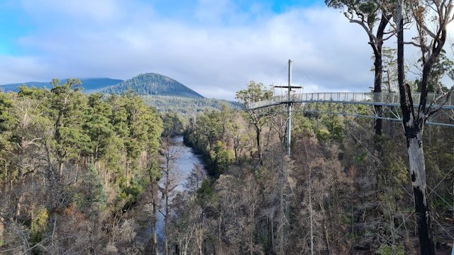
The best-known attraction is the Tahune Airwalk, an elevated walkway through the forest canopy that finishes at a cantilevered platform high above the riverbank. The site also includes the Huon Pine Walk and Swinging Bridges Track. 8
Tahune Airwalk
The Airwalk extends through the forest canopy and gives visitors a different perspective on the meeting of the Huon and Picton rivers and surrounding forest.
Current site information lists the attraction as open daily from 10:00 am to 4:00 pm, except Christmas Day and during hazardous weather conditions. 9
Tahune is around 1.5 hours by road from Hobart under normal conditions. The operator advises following the signed route from Geeveston rather than relying blindly on GPS, because mapping services can direct travellers onto unsuitable gravel roads. 10
Can You Reach Tahune Without a Car?
There is currently no ordinary public transport service directly to Tahune Adventures. Visitors without a vehicle may need to use an organised tour or private transport arrangement. 11
Melaleuca: Remote Southwest Tasmania Beyond the Road
Melaleuca is one of the clearest examples of why Southwest Tasmania should not be treated as an ordinary road-trip region.
There is no normal road access to Melaleuca.
Tasmania Parks and Wildlife Service states that direct access is by light aircraft or private boat. Melaleuca also connects with the South Coast Track and Port Davey Track for experienced wilderness walkers. 12
Flying to Melaleuca
Light aircraft services operate from the Hobart area, with flights dependent on weather.
Travellers undertaking the South Coast Track commonly fly into Melaleuca and walk out towards Cockle Creek because flight pickup can be affected by weather. 13
Why Melaleuca Matters
Melaleuca represents a different scale of Southwest Tasmania travel. It is not simply another attraction to add between Gordon Dam and Cockle Creek.
Its isolation, airstrip, waterways and connection with major wilderness tracks make it part of a much more remote travel experience.
South Coast Track
The South Coast Track is one of Tasmania’s major wilderness expeditions and should be described accordingly.
The track runs for approximately 85 kilometres between Melaleuca and Cockle Creek and is typically completed over about six to eight days. Parks explicitly describes it as considerably more difficult than the Overland Track. 14
Walkers encounter windswept beaches, rocky headlands, mountain terrain, buttongrass plains, mud and river crossings. There are no huts along most of the route after leaving Melaleuca, and participants need to be experienced and self-sufficient. 15
South Coast Track Is Not a Beginner Walk
This cannot be overstated.
The route involves remote-country decision-making, navigation, prolonged exposure to wet weather and significant logistical planning.
Strong wind, persistent rain and even snow at higher elevations can occur at any time of year. 16
Experienced walkers should consult the current official walk notes, weather information and registration requirements before departure rather than relying on a general tourism guide alone.
Port Davey Track
The Port Davey Track provides another major wilderness route through Southwest Tasmania and connects the Lake Pedder/Scotts Peak side of the region with Melaleuca.
From Huon Campground, the first section can be sampled as a short out-and-back walk through moorland and rainforest, but the full route continues for roughly 63 kilometres to Melaleuca and takes around four days under the current Parks description. 17
Beyond the easier first kilometre, Parks notes that the track becomes rougher and muddier. 18
The distinction between taking a short introductory walk and committing to the full Port Davey Track should remain very clear in trip planning.
Wildlife and Nature in Southwest Tasmania
Southwest Tasmania protects enormous areas of relatively undeveloped habitat, including rainforest, buttongrass moorland, alpine environments, wetlands, rivers and remote coastline.
Wildlife may include wallabies, pademelons, wombats, echidnas and many bird species, while waterways and coastal environments support their own specialised ecosystems.
Sightings are never guaranteed and should not be encouraged through feeding.
Wildlife on the Road
Parks and Wildlife Service advises visitors to avoid driving in reserves at night where possible because native wildlife shares these roads. 19
This advice is particularly relevant in remote areas where roads are dark, narrow and surrounded by bushland.
Birdlife
Forests, wetlands and open moorlands can provide rewarding birdwatching, particularly for travellers willing to stop and listen rather than remain inside the vehicle.
Use binoculars and distance rather than approaching nesting or feeding birds closely.
Photography in Southwest Tasmania
Southwest Tasmania is exceptionally rewarding for landscape photography because weather and light can transform the same scene within minutes.
Lake Pedder
Lake Pedder provides broad water-and-mountain compositions, reflections in calm conditions and dramatic weather when clouds move across the surrounding ranges.
Gordon Dam
The curved dam wall provides a strong geometric contrast with the surrounding wilderness and can be photographed from several public viewpoints.
Cockle Creek
Recherche Bay and the mountain backdrop can provide softer coastal compositions, while the South Cape Bay walk reveals a more exposed Southern Ocean environment.
Do not stop in unsafe positions on narrow roads simply because a view appears suddenly. Use proper pull-offs and designated parking where available.
Camping in Southwest Tasmania
Camping is one of the most immersive ways to experience Southwest Tasmania, but conditions are very different from a serviced holiday park.
Campgrounds around Lake Pedder, Scotts Peak Road and Cockle Creek generally provide simple facilities rather than extensive services.
Carry enough food, water-treatment capability where needed and appropriate equipment for cold, wet and windy weather.
Lake Pedder Area Campgrounds
Camping areas include locations such as Teds Beach and Huon Campground, subject to current access and management conditions.
Non-treated rainwater is available from tanks at selected campgrounds, including Huon, Teds Beach and Edgar, but untreated water should be managed appropriately before drinking. 20
Cockle Creek Camping
Camping around Cockle Creek and Recherche Bay can provide direct access to the far-southern coast and South Cape Bay trailhead.
Always check current closures and campground alerts immediately before travelling because infrastructure works can affect individual sites.
Weather and Best Time to Visit Southwest Tasmania
Southwest Tasmania is a year-round destination for appropriately prepared travellers, but weather is one of the most important planning factors in the region.
Rain, strong wind, cold temperatures, low cloud and rapid changes are all normal possibilities.
Summer: December to February
Summer provides the longest daylight hours and can make scenic driving and day walking easier to schedule.
However, the South West should never be treated as reliably warm or dry simply because it is summer.
Autumn: March to May
Autumn can suit road trips, photography and walking, particularly when conditions are stable.
Daylight becomes shorter later in the season, which matters on remote roads and longer walks.
Winter: June to August
Winter brings shorter days, colder temperatures and a greater chance of snow and ice in elevated areas.
Hartz Mountains road access may be affected, and alpine walks require considerably more caution.
Spring: September to November
Spring brings increasing daylight but can remain highly changeable.
Flexible planning is valuable because a clear day can often be used more effectively for mountain routes while wetter days can be reserved for caves, forests or slower driving.
What to Pack for Southwest Tasmania
- Warm layers
- Waterproof outer shell
- Comfortable and appropriate footwear
- Food and water for remote drives
- Offline maps
- Phone charger or power bank
- Sun protection
- Basic emergency supplies
- Any essential medications
- Extra clothing for longer walks
Longer wilderness walks require a substantially more advanced equipment list than ordinary roadside travel. Use the relevant Parks walk notes and safety guidance when preparing for remote tracks.
Southwest Tasmania with Families
Families can experience Southwest Tasmania successfully, but the itinerary should be built around shorter walks, realistic driving times and reliable access to food and facilities.
Lake Pedder, Gordon Dam, selected rainforest walks, Hastings Caves, Tahune Adventures and Cockle Creek can all offer family-friendly experiences when conditions suit.
The remote multi-day wilderness tracks are a different category and should not be assumed suitable merely because children enjoy ordinary hiking.
Good Family Stops
- Lake Pedder viewpoints
- Gordon Dam
- Selected short rainforest walks
- Hastings Caves and Thermal Springs
- Tahune Airwalk
- Cockle Creek shoreline
- South Cape Bay only for families comfortable with a substantial day walk
Accessibility in Southwest Tasmania
Accessibility varies enormously across Southwest Tasmania.
Some roadside viewpoints and developed attractions can be reached with relatively limited walking, while national park tracks, dam access, caves and mountain routes may involve steps, steep surfaces or rough terrain.
If step-free access, accessible toilets, parking or mobility assistance is essential, confirm current arrangements directly with each attraction or managing authority before travelling.
Do not assume that because a destination is road-accessible, every part of the visitor experience is accessible.
Responsible Travel in Southwest Tasmania
The environmental value of Southwest Tasmania depends heavily on visitors treating remote places carefully.
Stay on Established Tracks
Buttongrass, alpine vegetation and wetland environments can be damaged by repeated off-track movement.
Follow Fuel-Stove Rules
Some remote areas are designated Fuel Stove Only and campfires are prohibited. For example, the South Coast Track is within a Fuel Stove Only area. 21
Take Waste Out
Remote campgrounds and tracks do not have the same waste services as towns. Carry rubbish out rather than leaving it beside overloaded bins or at campsites.
Respect Wildlife
Do not feed wildlife or approach animals closely for photographs.
Suggested Southwest Tasmania Itineraries
Because Southwest Tasmania is divided into separate road-accessible gateways, itineraries should be designed around geography rather than trying to connect every destination directly.
One-Day Gordon Dam and Lake Pedder Trip
A one-day trip is possible from Hobart but makes for a long day.
- Leave Hobart early.
- Travel through the Derwent Valley towards Maydena.
- Refuel before continuing west.
- Follow Gordon River Road into Southwest National Park.
- Stop at selected Lake Pedder viewpoints.
- Continue to Strathgordon and Gordon Dam.
- Allow time to explore the dam rather than simply photographing it.
- Return during daylight where practical.
This itinerary is better when the road journey itself is treated as the experience rather than attempting additional major attractions on the same day.
Three-Day Southwest Tasmania Itinerary
Day 1 — Gordon River Road: Travel from Hobart through the Derwent Valley, refuel before Maydena and continue to Lake Pedder. Stay around Strathgordon or another suitable location.
Day 2 — Gordon Dam and Lake Pedder: Explore Gordon Dam, selected Lake Pedder viewpoints and shorter walks without needing to rush back to Hobart.
Day 3 — Return via Mount Field or Derwent Valley: Rather than adding Cockle Creek, which lies in a completely different direction, return through the Derwent Valley and incorporate an appropriate nearby stop.
Five-Day Southwest and Far South Itinerary
This itinerary combines two different wilderness gateways rather than pretending they are directly connected.
Day 1 — Hobart to Lake Pedder: Travel through Maydena into Southwest National Park and stay around Strathgordon.
Day 2 — Gordon Dam and northern Southwest: Explore Gordon Dam, Lake Gordon and Lake Pedder.
Day 3 — Transition south: Return towards Hobart or the Huon side and reposition for the Far South. This day is intentionally less crowded because the two road systems do not connect through the wilderness.
Day 4 — Hastings Caves and Far South: Visit Hastings Caves and Thermal Springs, then continue towards Southport or accommodation farther south.
Day 5 — Cockle Creek: Drive to Cockle Creek and explore the shoreline or undertake the South Cape Bay walk if conditions, fitness and daylight are suitable.
Seven-Day South West Tasmania Itinerary
Seven days allows the region to be explored much more realistically.
Day 1: Hobart to Lake Pedder via the Derwent Valley.
Day 2: Gordon Dam, Lake Gordon and Strathgordon.
Day 3: Scotts Peak Road and selected short walks or lake viewpoints.
Day 4: Return east and reposition towards the Huon Valley.
Day 5: Tahune Adventures or Hartz Mountains, depending on weather and interests.
Day 6: Hastings Caves and Far South.
Day 7: Cockle Creek and South Cape Bay or a slower coastal day.
Southwest Tasmania Road Trip Planning
A Southwest Tasmania road trip is different from the island’s coastal routes because there is no through-road connecting the major wilderness gateways.
This makes backtracking unavoidable in places.
Rather than seeing this as wasted time, treat each access road as its own scenic journey.
Southwest Tasmania + Hobart
Hobart is the most practical urban base for beginning or ending a South West journey.
Use our Hobart Tasmania Travel Guide for the city portion of your trip.
Southwest Tasmania + South Tasmania
The Huon Valley, Far South, Bruny Island, Tasman Peninsula and Derwent Valley can all be incorporated into a broader southern itinerary.
Use our South Tasmania Travel Guide to plan the surrounding region.
Southwest Tasmania + Central Highlands
Travellers exploring Lake Pedder and the Derwent Valley can later continue towards Tasmania’s interior rather than immediately returning to the coast.
See our Central Highlands Tasmania Travel Guide.
Southwest Tasmania + West Coast
The West Coast and South West share a sense of remoteness, but there is no simple road crossing straight through the protected wilderness between them.
Plan the western stage separately using our West Coast Tasmania Travel Guide.
For the complete statewide route, return to Travel Tasmania: The Complete Guide to Every Region.
Frequently Asked Questions About Southwest Tasmania
Is Southwest Tasmania worth visiting?
Yes, particularly for travellers interested in remote landscapes, scenic drives, lakes, wilderness, photography and walking. It is less suited to travellers expecting many towns or attractions close together.
What are the best places to visit in Southwest Tasmania?
Major road-accessible places include Lake Pedder, Gordon Dam, Lake Gordon, Strathgordon, Cockle Creek, South Cape Bay, Hartz Mountains and Hastings Caves. Tahune Adventures can also fit naturally into a wider Huon and South West itinerary.
Can you drive through Southwest Tasmania?
No. There is no public road crossing the entire South West. Roads enter different parts of the region but large areas remain roadless wilderness.
Do you need a 4WD in Southwest Tasmania?
Many major road-accessible attractions can be reached by conventional vehicles under suitable conditions. Some roads are unsealed, so check current road conditions and rental-company restrictions before travelling.
Can a 2WD reach Cockle Creek?
Current Tasmania Parks advice states that the final gravel road can be negotiated by two-wheel-drive vehicles with care. Conditions can change, so check before departure. 22
Where is the last fuel before Gordon Dam?
Parks currently advises that fuel is not available past Maydena on the Lake Pedder and Gordon Dam route. 23
Where is the last fuel before Cockle Creek?
Parks currently advises that there is no fuel beyond Southport on the Cockle Creek approach. 24
Is Gordon Dam worth visiting?
Yes, especially for travellers interested in engineering and remote landscapes. The drive through Lake Pedder country is a major part of the experience.
Can you visit Gordon Dam from Hobart in one day?
Yes, but it creates a long day. Staying near Strathgordon provides more time to explore Lake Pedder and the surrounding landscape without rushing.
Is Lake Pedder natural?
The original natural Lake Pedder was substantially transformed and submerged during hydro-electric development in the early 1970s, creating today’s much larger impoundment.
Can you camp in Southwest National Park?
Yes, designated camping areas are available in several road-accessible parts of the park. Facilities are generally basic and current closures or restrictions should be checked before travelling.
Do you need a parks pass for Southwest National Park?
Yes. Current Tasmania national park entry requirements apply.
Can you drive to Melaleuca?
No. Direct access to Melaleuca is by light aircraft or private boat, while experienced walkers can reach it via major wilderness tracks. 25
How long is the South Coast Track?
The South Coast Track is approximately 85 kilometres and generally takes around six to eight days. It is a demanding wilderness route for experienced and self-sufficient walkers. 26
Is the South Coast Track harder than the Overland Track?
Tasmania Parks and Wildlife Service explicitly describes the South Coast Track as much more difficult than the popular Overland Track. 27
Is Hartz Mountains National Park worth visiting?
Yes, particularly for travellers interested in alpine scenery and walking. Weather and road conditions should be checked because snow can affect access in winter.
Can you visit Hastings Caves and Cockle Creek in one day?
It is possible for travellers starting nearby, but from Hobart it can become a long day. If you want a cave tour, thermal pool and meaningful time at Cockle Creek, an overnight stay in the Far South usually creates a better itinerary.
Is Southwest Tasmania suitable for families?
Yes, when the trip focuses on scenic drives, shorter walks, Hastings Caves, Tahune Adventures and road-accessible destinations. Remote multi-day tracks require a very different level of experience and preparation.
How many days do you need in Southwest Tasmania?
Three days provides a useful introduction to one main gateway. Five to seven days is more suitable if you want to combine Lake Pedder and Gordon Dam with the Huon/Far South and Cockle Creek.
What is the best time of year to visit Southwest Tasmania?
Summer provides the longest daylight hours, but the South West can experience cold, wet and windy conditions at any time. The best period depends on your planned activities and experience level.
Plan Your Southwest Tasmania Trip
The most important step in planning Southwest Tasmania is understanding what the road network does not do.
There is no convenient driving loop through the wilderness.
Lake Pedder and Gordon Dam sit at the end of one long wilderness approach. Cockle Creek lies at the end of another. Hartz Mountains and Tahune form separate Huon-side experiences, while Melaleuca belongs to an entirely different level of remote access.
Once this geography is understood, the region becomes easier to plan.
Choose one gateway if you have only one or two days. Combine Lake Pedder and Gordon Dam over several days if engineering, lakes and wilderness scenery are your priority. Add Cockle Creek and the Far South when you have enough time to reposition rather than forcing both routes into one long day.
And if your goal is the true roadless interior—the South Coast Track, Western Arthurs, Mount Anne or Melaleuca—plan it as a wilderness expedition rather than a normal tourism day trip.
For broader southern planning, continue with our South Tasmania Travel Guide and Hobart Tasmania Travel Guide.
If the South West is part of a statewide road trip, use Travel Tasmania: The Complete Guide to Every Region and our complete Tasmania trip planning guide before finalising the route.
Book and Organise Your Southwest Tasmania Trip
Once you have chosen which gateway you are visiting, organise transport and overnight stays around that route rather than choosing accommodation first and attempting to make the geography fit afterward.
- Flights: compare flights for your Tasmania trip.
- Accommodation: compare accommodation around Hobart, southern Tasmania and the South West.
- Car hire: compare Tasmania rental car options.
- Camping and campervan planning: browse Camps Australia Wide travel guides.
- International mobile data: explore Airalo eSIM options.
Affiliate disclosure: Some links on this page are affiliate links. Island Files Tasmania may receive a commission from eligible bookings or purchases made through these links at no additional cost to you. Affiliate relationships do not change our aim of providing useful and neutral travel-planning information.
Travel information note: Southwest Tasmania is a remote region where roads, campgrounds, national park alerts, walking-track conditions, fuel availability and weather can change. Always check current official information immediately before travelling, particularly for wilderness walks, unsealed roads and overnight camping.